Iceberg/ice island mapping
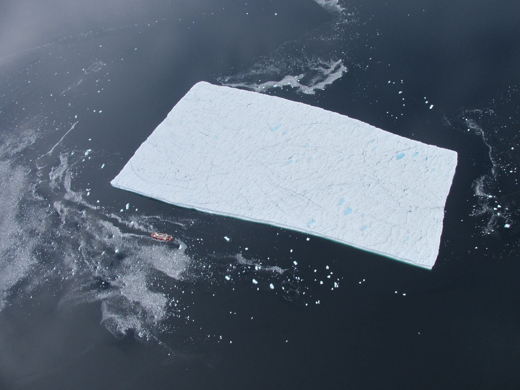
An ice island in Kane Basin with numerous, small fragments, produced during its deterioration, in the surrounding water. Photo credit: Jean-Éric Tremblay and Guillaume Carpentier.
At WIRL we are interested in measuring the deterioration of icebergs and ice islands which results from numerous physical processes. Due to the logistical difficulty of conducting ice island field work, observations of ice island deterioration are sparse, yet these data sets are very important for our analysis and modeling efforts.
A long term goal at WIRL is to record the pattern and magnitude of ice island deterioration at the same time as observing environmental conditions (e.g., ocean currents, waves, wind as well as air and water temperature). Before we organize field campaigns which are dedicated to observing ice island deterioration, we first need to know how well we can measure the shape of an ice island or iceberg , as well as the benefits (or limitations) of different surveying techniques.
In 2015, WIRL members Anna Crawford and Derek Mueller conducted a field campaign to determine the capabilities of three surveying methods for deterioration observation. This field work was conducted from the CCGS Amundsen during a joint ArcticNet/Statoil research cruise offshore Newfoundland and Labrador. The methods included laser scanning and structure-from-motion, aerial photogrammetry for surveying ice island sails (the above water portion), and multi-beam sonar for surveying ice island keels (the underwater portion). The deployment of tracking beacons on the ice island field subjects was an important step for all of these surveying methods, for either 1) providing scale, or 2) correcting survey data for the drift of the survey target.
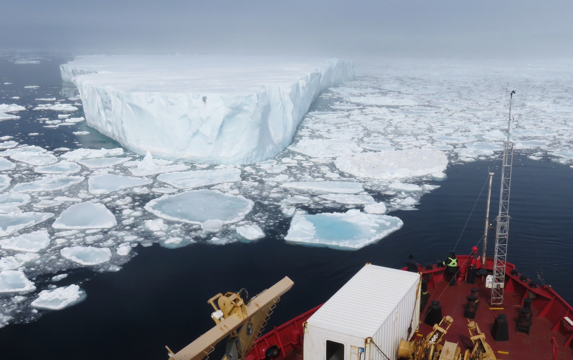
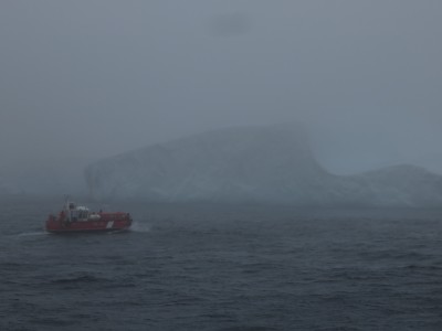
The CCGS Amundsen approaching an ice island fragment. Photo credit: Greg McCullough
With this analysis, we now know how much deterioration which must occur to an ice island before we can detect it. We also know the uncertainty in the methods for estimating an ice feature’s mass. Finally, we now have valuable experience with these surveying techniques and know the benefits and limitations of each of these techniques. We will now be well prepared for future field campaigns to measure ice island deterioration.
Support
Funding for this project has been provided by ArcticNet and Statoil ASA (Tom McKeever, Sigurd Henrik Teigen, Jens Christian Roth, Dave Barber and Keith Levesque). Transportation was provided by the Canadian Coast Guard and Transport Canada (Alain Lacerte, Dick Morissette and Olivier Talbot. Members of the Laboratoire de géosciences marine (LGM) at Laval University assisted during the field campaign and during the post-trip analysis (Gabriel Joyal, Jean-Guy Nistad, Annie-Pier Trottier and Patrick Lajaunesse). Seahorse Geomatics assisted with field work preparations and analysis (Josh Sampey and Mike Mutschler). The Canadian Ice Service has continually supported WIRL field campaigns (Matt Arkett, Angela Cheng, Hugo Drouin, and Leah Braithwaite), and additional input was provided by WIRL members Ron Saper and Luc Desjardins.
Gallery 1 (Tiled Mosaic)
-
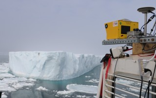
- The multi-beam surveys of the ice island keels were conducted from the CCGS Amundsen’s barge. The survey target is in the background. Photo credit: Greg McCollough
-
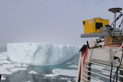
- The laser scan equipment mounted and in use for surveying an ice island fragment. Photo credit: Gabriel Joyal
-
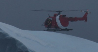
- Placing a beacon on an iceberg. Photo credit: Greg McCollough
-
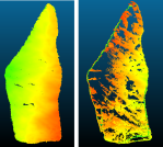
- 3D models generated from SfM-photogrammetry (right) and laser scanning (left) of the same ice island.
-
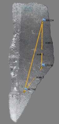
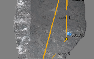
- Example of a point cloud (3D model) generated with photogrammetry surveying and SfM processing. Lines denote distances between deployed beacons – used for scale assignment.
-
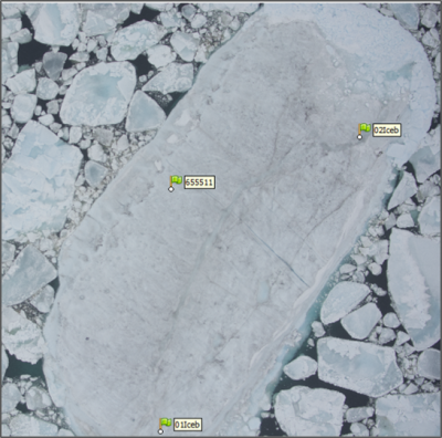
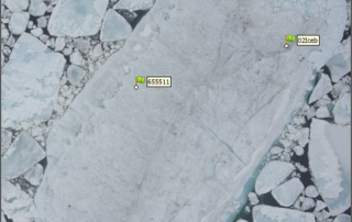
- Example of an aerial photograph taken during SfM-photogrammetry surveying, and the GPS units marked.
-
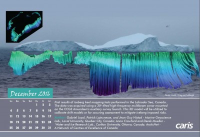
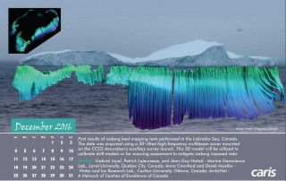
- Mutlibeam survey of the ‘saddle berg’. This figure, produced by Gabriel Joyal at Laboratoire de géosciences marine (Laval University), was featured in the 2016 CARIS calendar.
Gallery 2 (Thumbnail Grid)
-
- The multi-beam surveys of the ice island keels were conducted from the CCGS Amundsen’s barge. The survey target is in the background. Photo credit: Greg McCollough
-
- The laser scan equipment mounted and in use for surveying an ice island fragment. Photo credit: Gabriel Joyal
-
- Placing a beacon on an iceberg. Photo credit: Greg McCollough
-
- 3D models generated from SfM-photogrammetry (right) and laser scanning (left) of the same ice island.
-
- Example of a point cloud (3D model) generated with photogrammetry surveying and SfM processing. Lines denote distances between deployed beacons – used for scale assignment.
-
- Example of an aerial photograph taken during SfM-photogrammetry surveying, and the GPS units marked.
-
- Mutlibeam survey of the ‘saddle berg’. This figure, produced by Gabriel Joyal at Laboratoire de géosciences marine (Laval University), was featured in the 2016 CARIS calendar.
Gallery 3 (Slideshow)