Summer 2008 loss of Arctic ice shelves
Press Release September 2, 2008
Images related to specific ice shelves: Ellesmere Island Ice Shelves Markham Ice Shelf Serson Ice Shelf Ward Hunt Ice Shelf
Ellesmere Island Ice Shelves
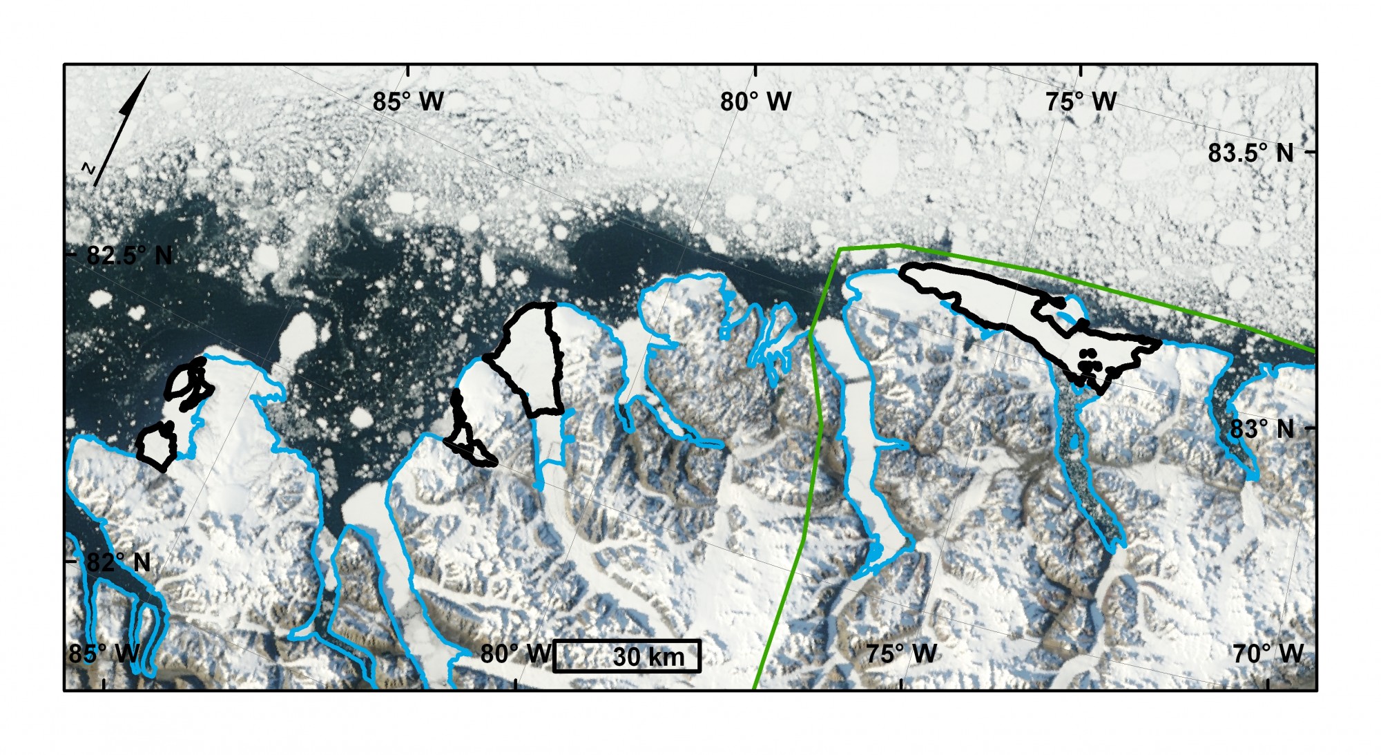
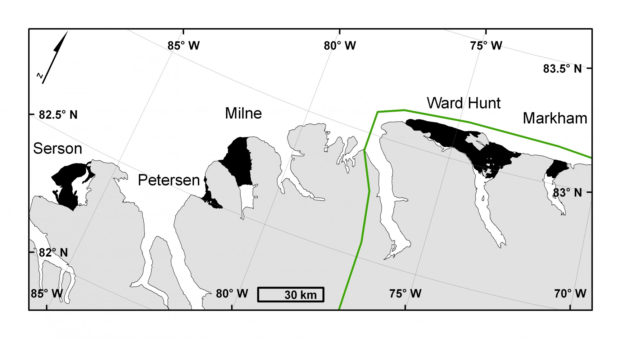
Map of Ellesmere Island ice shelves at the end of August 2008. Ice shelves are outlined in black. Left to Right: Serson, Petersen, Milne and Ward Hunt. Quttinirpaaq National Park outlined in green. August 29, 2008 MODIS image from the Rapid Response Project at NASA/GSFC. Map courtesy of Derek Mueller, Trent University.
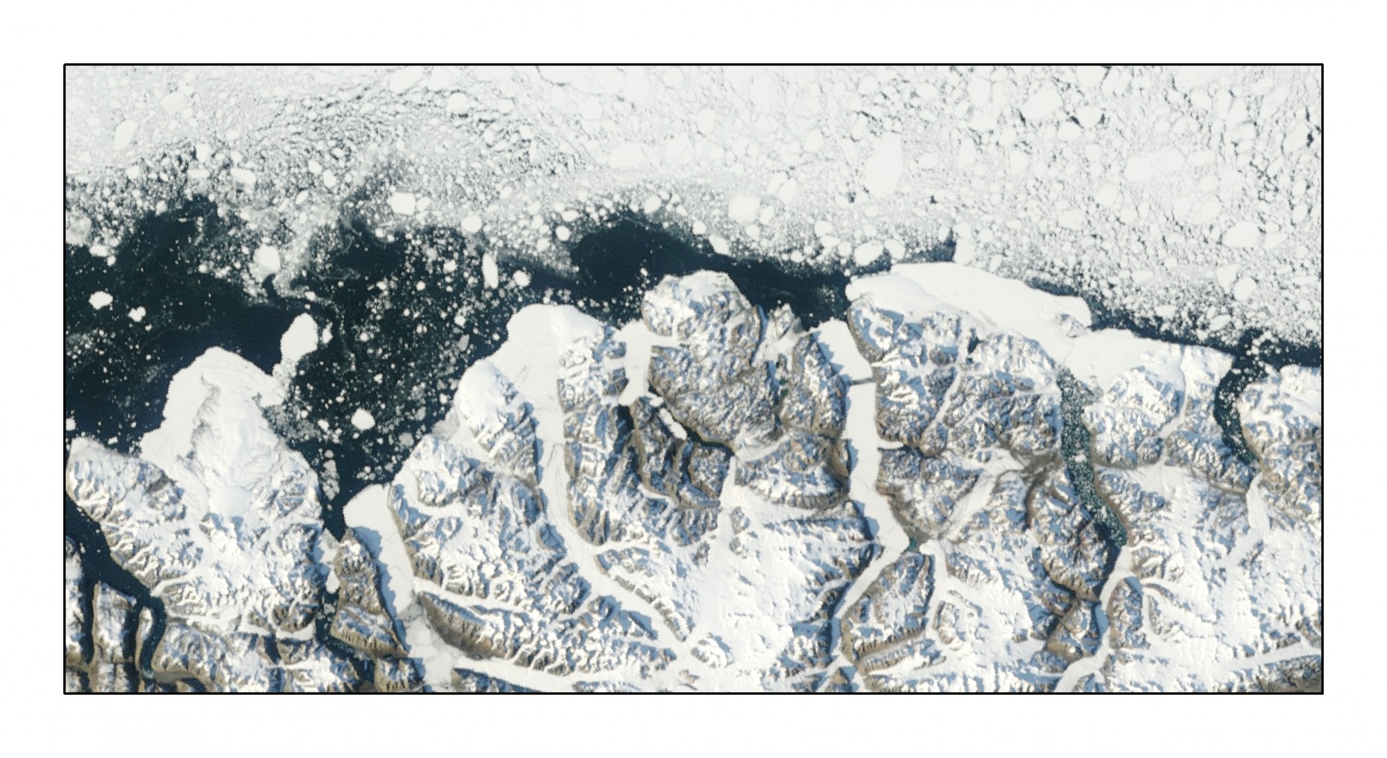
Unannotated Version Simple Map
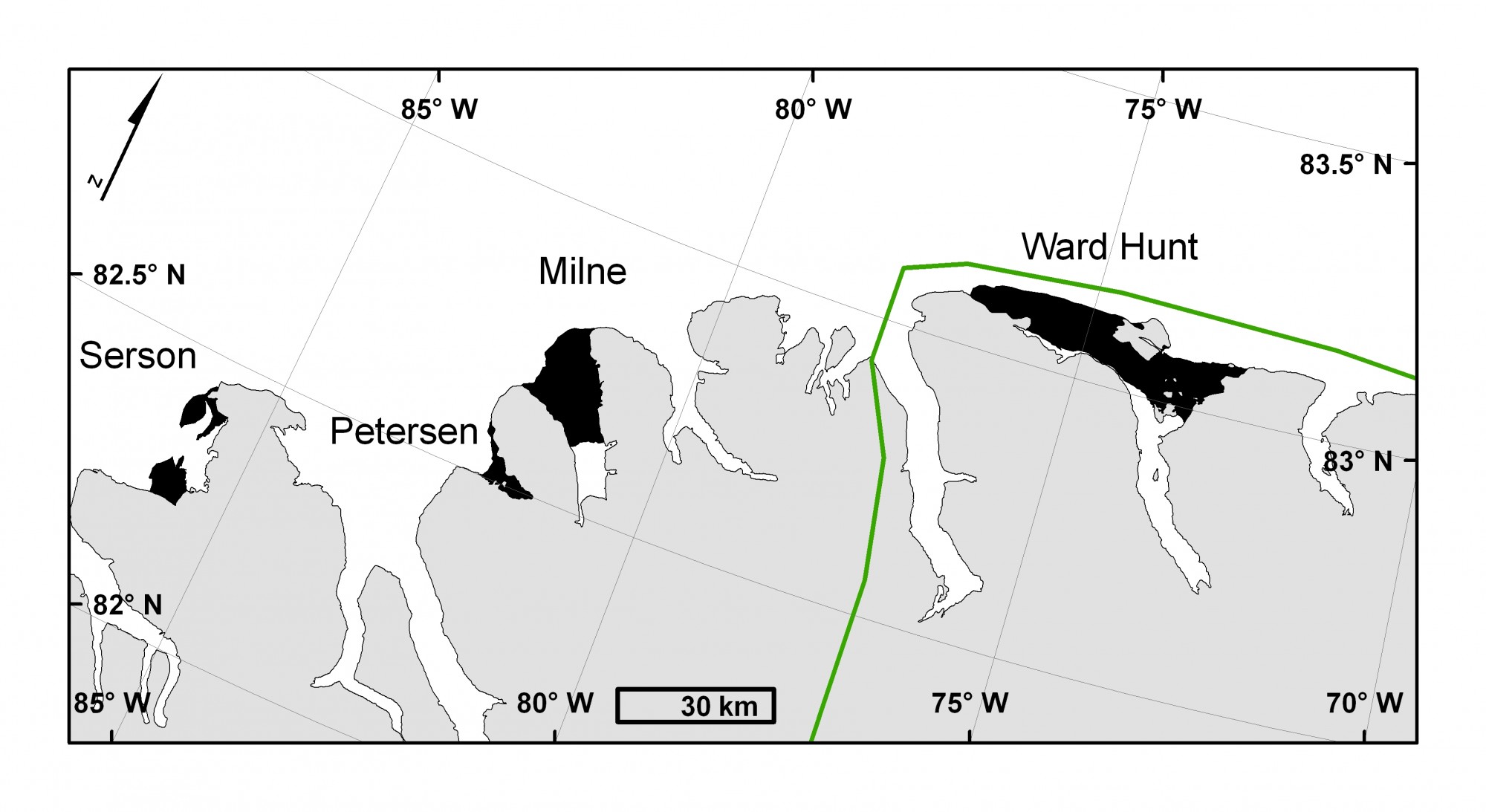
Map of Ellesmere Island ice shelves at the end of August 2007. Ice shelves are outlined in black. Left to Right: Serson, Petersen, Milne, Ward Hunt and Markham. Quttinirpaaq National Park outlined in green. August 30, 2007 MODIS image from the Rapid Response Project at NASA/GSFC. Map courtesy of Derek Mueller, Trent University.
Markham Ice Shelf
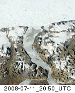
1) The Markham Ice Shelf break-up animated using cloud-free MODIS images. The animation shows an area that is approximately 40 km wide. MODIS image from the Rapid Response Project at NASA/GSFC. Animation courtesy Derek Mueller, Trent University.

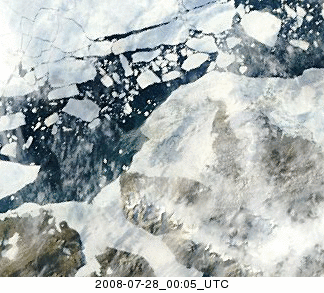
2) A MODIS image of the Markham Ice Shelf (2006 extent outlined in red) on July 28, 2008 prior to calving. Note the open water in Markham Fiord south of the ice shelf. MODIS image from the Rapid Response Project at NASA/GSFC. Map courtesy Derek Mueller, Trent University.
3) A MODIS image of the Markham Ice Shelf (2006 extent outlined in red) on August 6, 2008 starting to disintegrate. MODIS image from the Rapid Response Project at NASA/GSFC. Map courtesy Derek Mueller, Trent University.
4) A MODIS image of Markham Fiord on August 12, 2008 following the loss of the Markham Ice Shelf (2006 extent outlined in red). MODIS image from the Rapid Response Project at NASA/GSFC. Map courtesy Derek Mueller, Trent University.
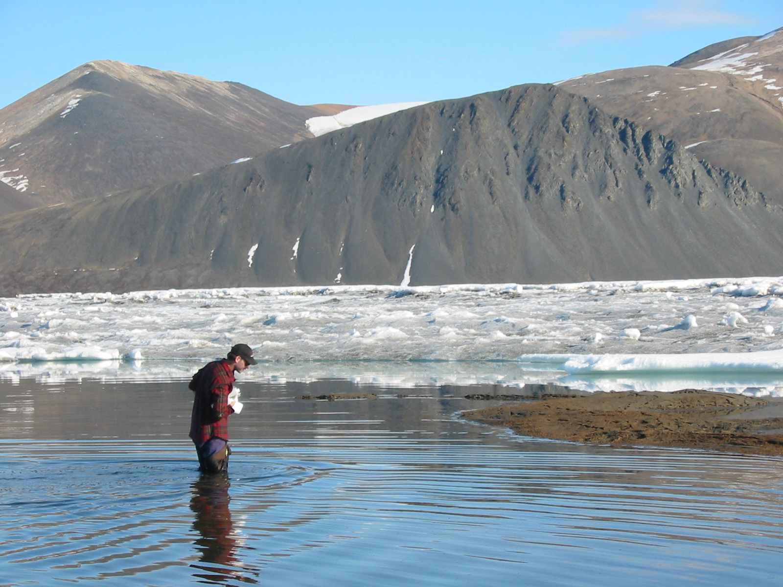
5) Dr. Derek Mueller walks into a shallow meltwater lake to sample the microbial communities that inhabited the surface of the Markham Ice Shelf in July 2002.
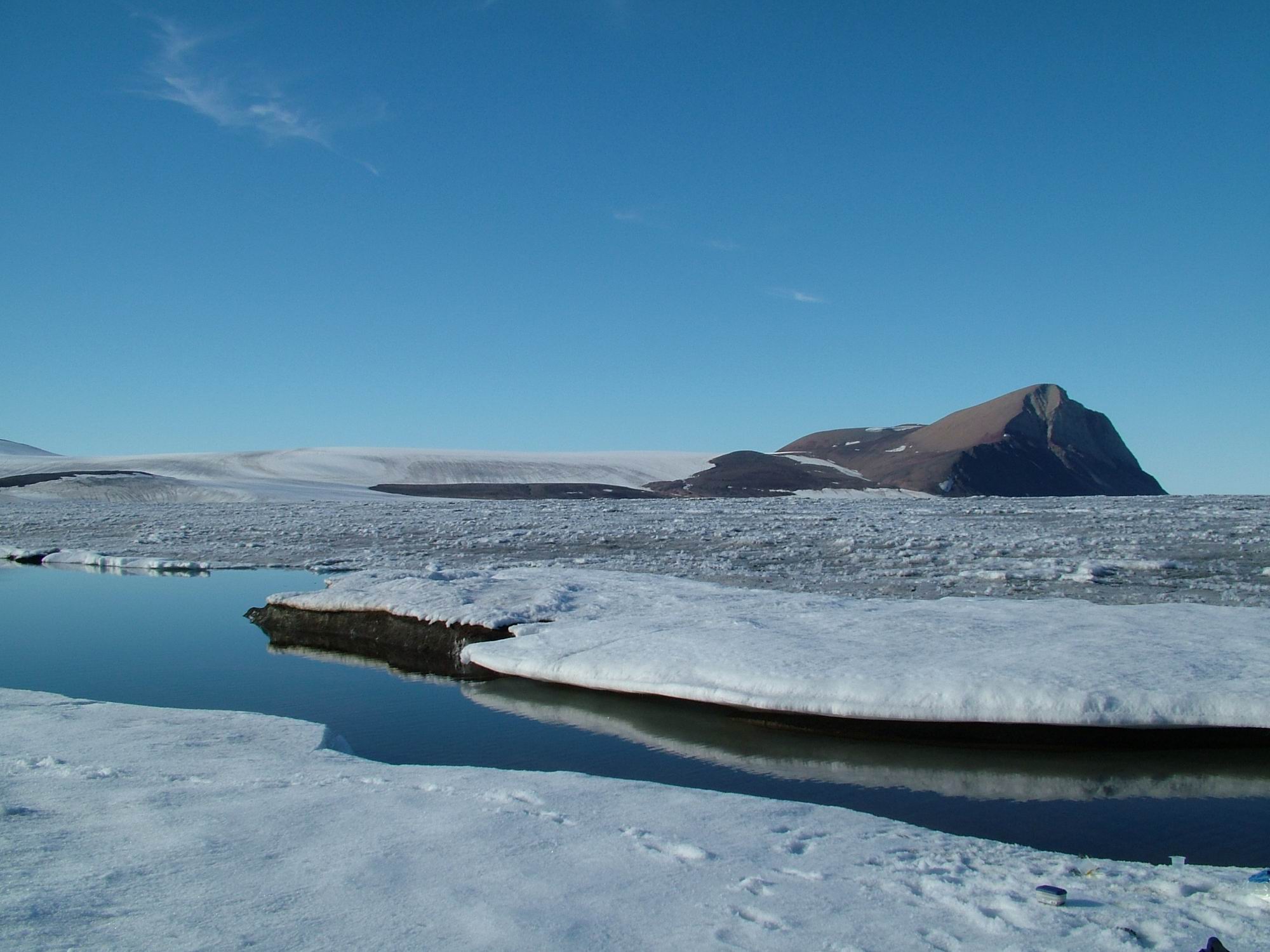
6) A melt water lake on the surface of the Markham Ice Shelf with Cape Nares in the background (August 2005). Photo courtesy of Denis Sarrazin, Laval University.
7) Long melt water lakes which contain microbial life on the Markham Ice Shelf viewed from a helicopter in August 2005. Photo courtesy of Denis Sarrazin, Laval University.
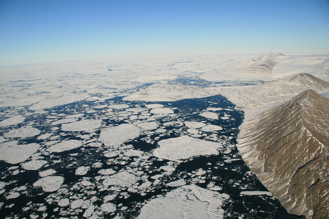
8) Markham Fiord in August 2008 after the Markham Ice Shelf broke away. Compare with the photograph above. Photo courtesy of Denis Sarrazin, Laval University.

9) Dr. Milla Rautio and Dr. Derek Mueller sample microbial pigments on the Markham Ice Shelf in August 2003. The algae that live on these ice shelves contain a variety of sunscreen and carotenoid pigments to cope with their stressful environment. Photo courtesy of Warwick Vincent, Laval University.
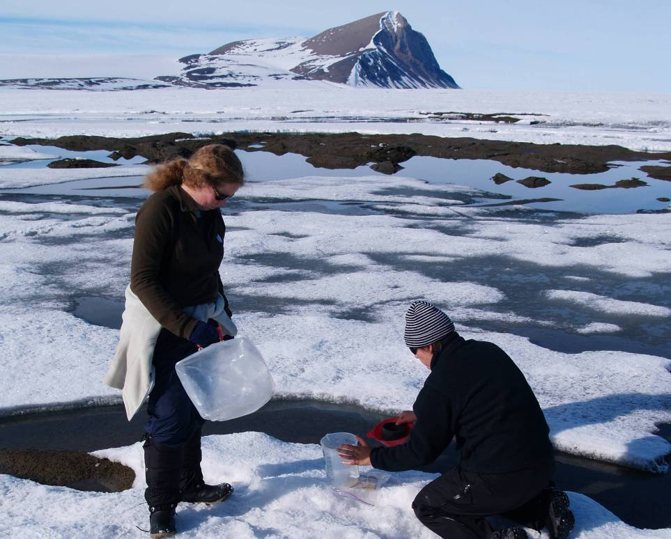
10) Scientists sample microbial communities that live on the surface of the Markham Ice Shelf in July 2007. The ecology of the Markham Ice Shelf is part of an International Polar Year Project (www.cen.ulaval.ca/merge/). Photo courtesy of Warwick Vincent, Laval University.
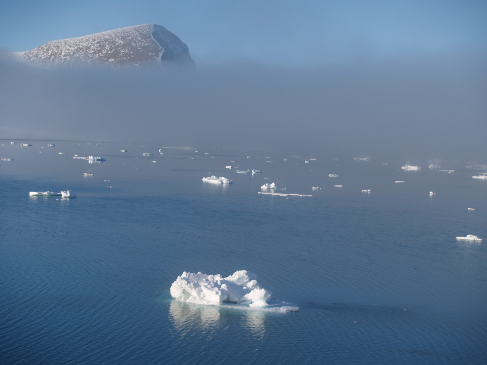
11) Markham Fiord in August 2008 after the Markham Ice Shelf broke away. Compare with the photograph above. Photo courtesy of Warwick Vincent, Laval University.
12) One of several ice islands that formed when the Markham Ice Shelf disintegrated. This ice island is 3.8 km long by 1.5 km wide. Photo courtesy of Warwick Vincent, Laval University.
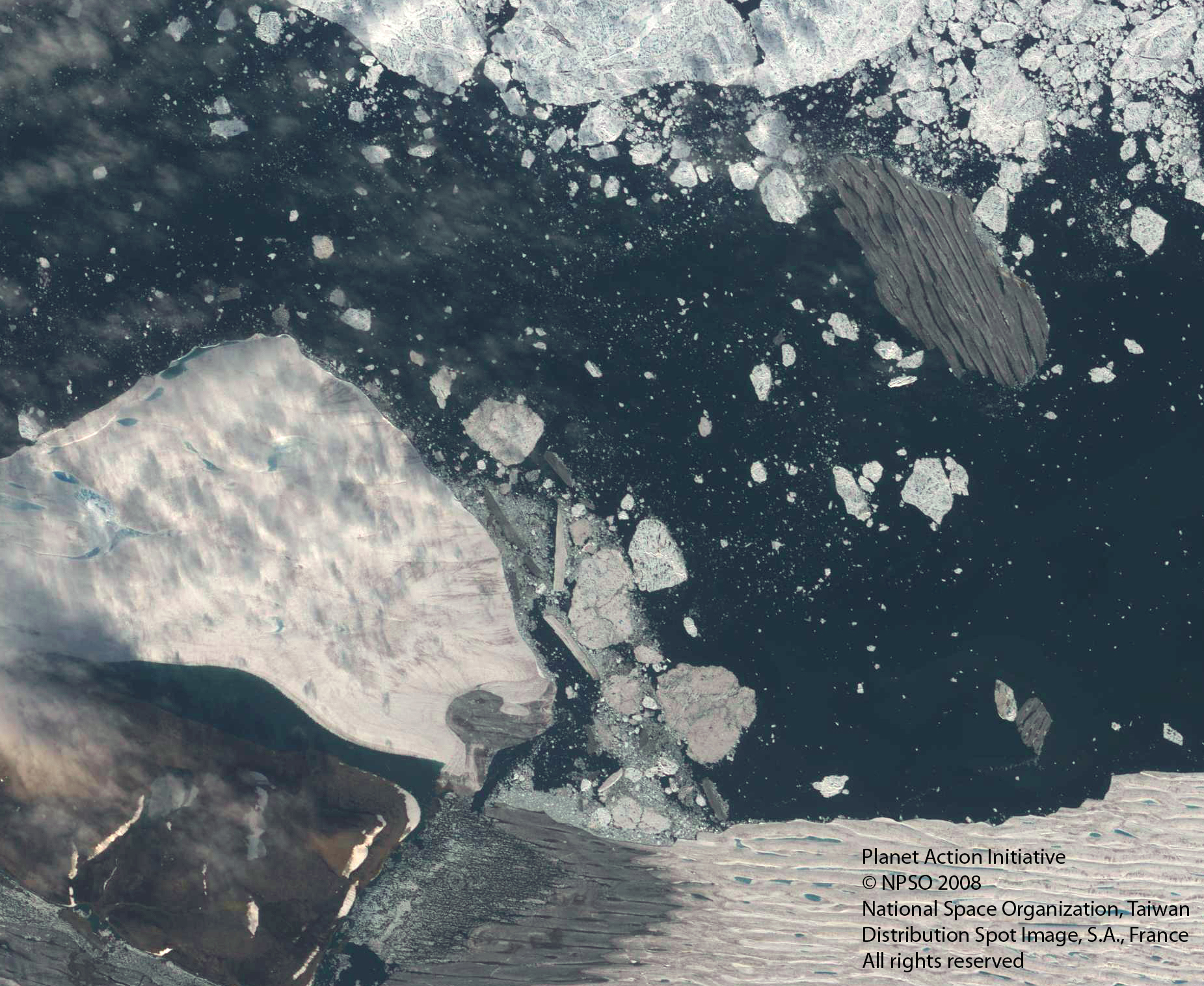
IDL TIFF file
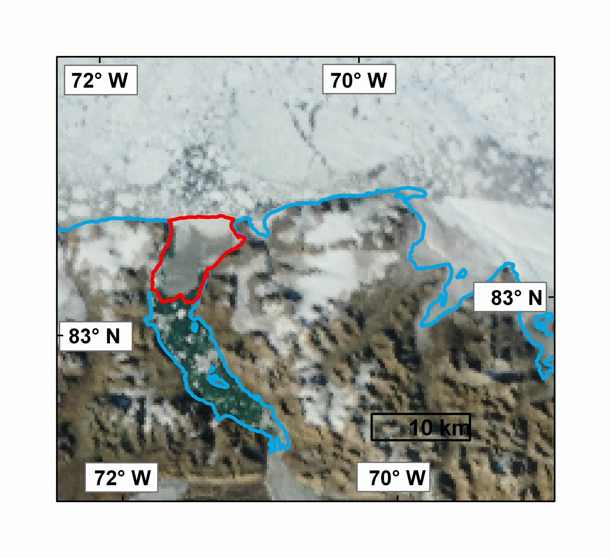
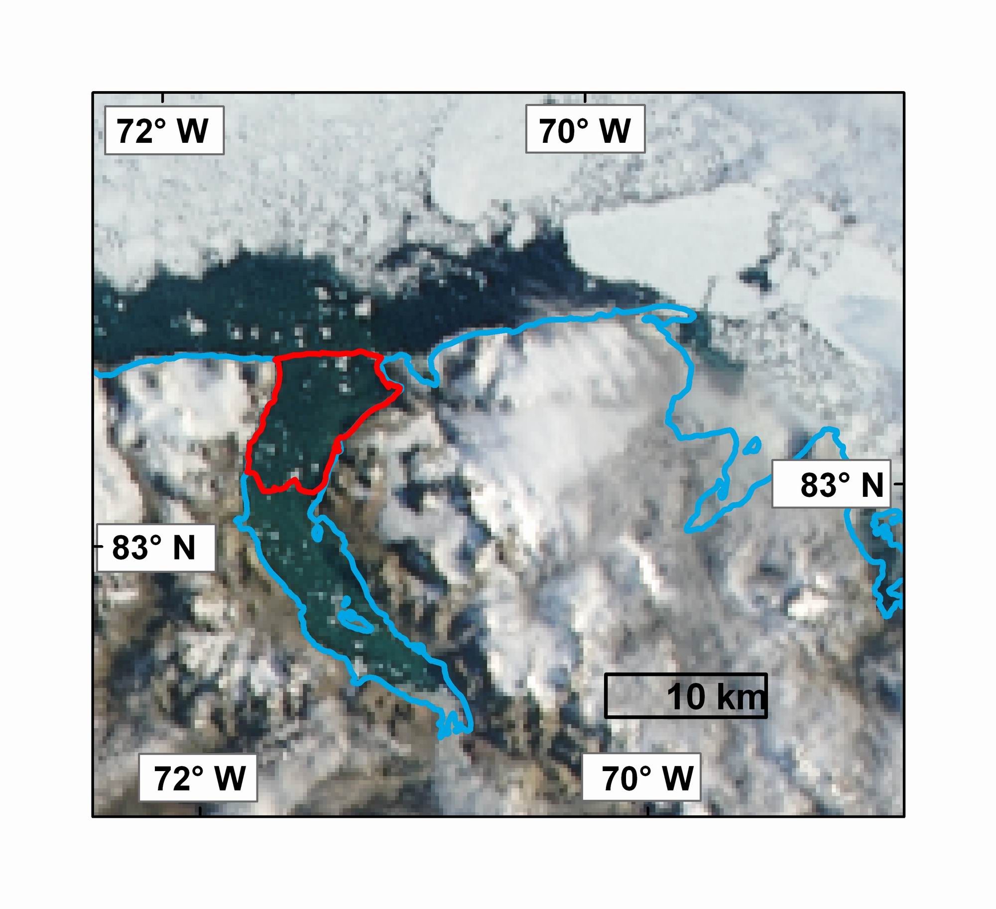
13) The ice island pictured above as it drifts westward past the Ward Hunt Ice Shelf. Formosat-2 image courtesy of Pax Arctica and the Planet Action Initiative, © NSPO 2008 – National Space Organization, Taiwan, Distribution Spot Image S.A., France, All rights reserved.
Serson Ice Shelf
1) The Serson Ice Shelf break-up animated using cloud-free MODIS images. The animation shows an area that is approximately 80 km wide. MODIS image from the Rapid Response Project at NASA/GSFC. Animation courtesy Derek Mueller, Trent University.

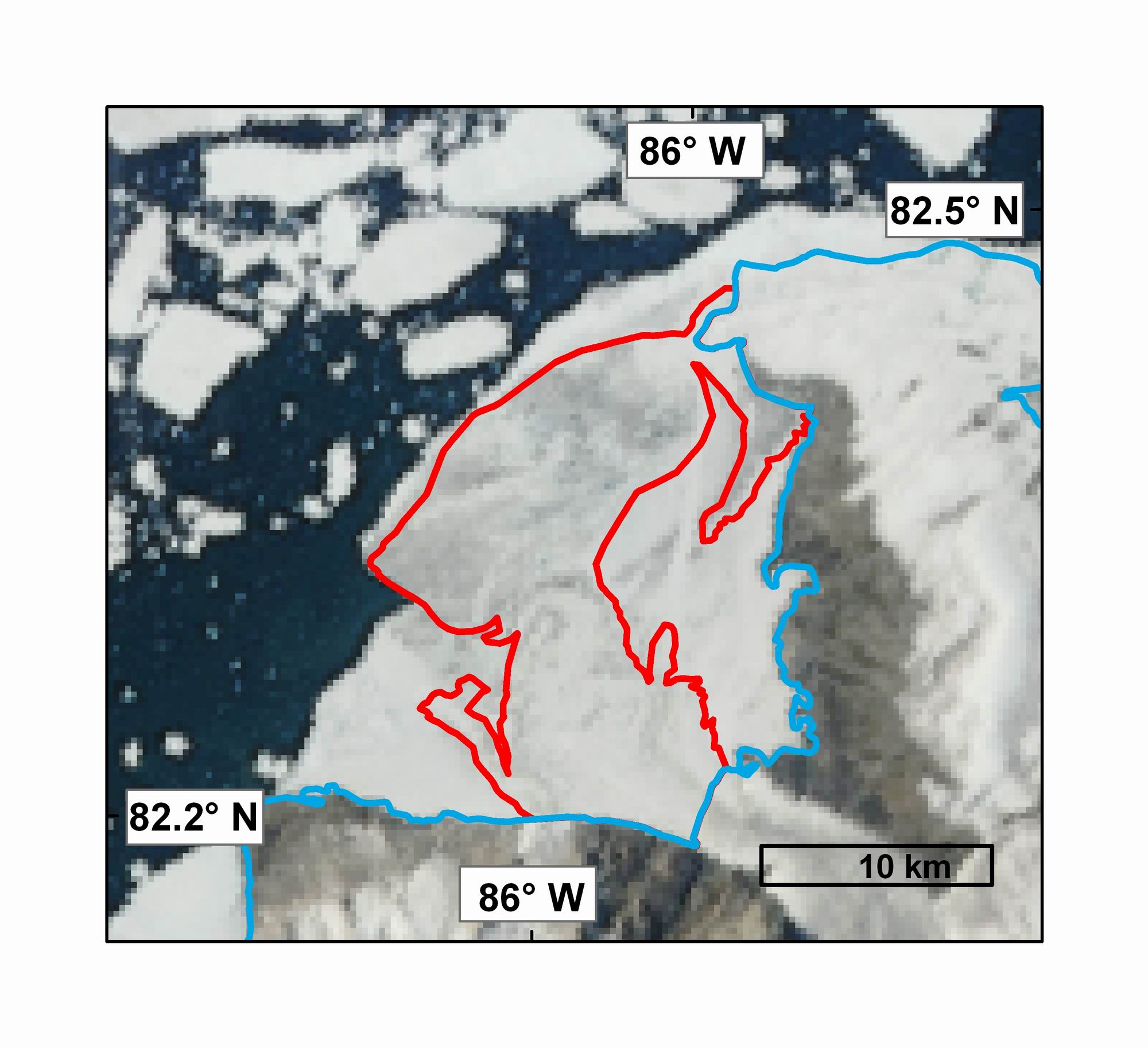
2) A map of the Serson Ice Shelf (2006 extent outlined in red) before it began to break-up in July based on RADARSAT-1 fine beam imagery from February 2008. The Serson Ice Shelf is composed of two sections, one comprised of glacier ice flowing off of Ellesmere Island and another section composed of ancient sea ice and snow that have accumulated over thousands of years. The ice shelf is estimated at 40 m thick and is fringed by thinner multiyear sea ice that helped protect it from the pack ice of the Arctic Ocean. RADARSAT-1 image copyright Canadian Space Agency, processed at the Alaska Satellite Facility. Map courtesy Derek Mueller, Trent University
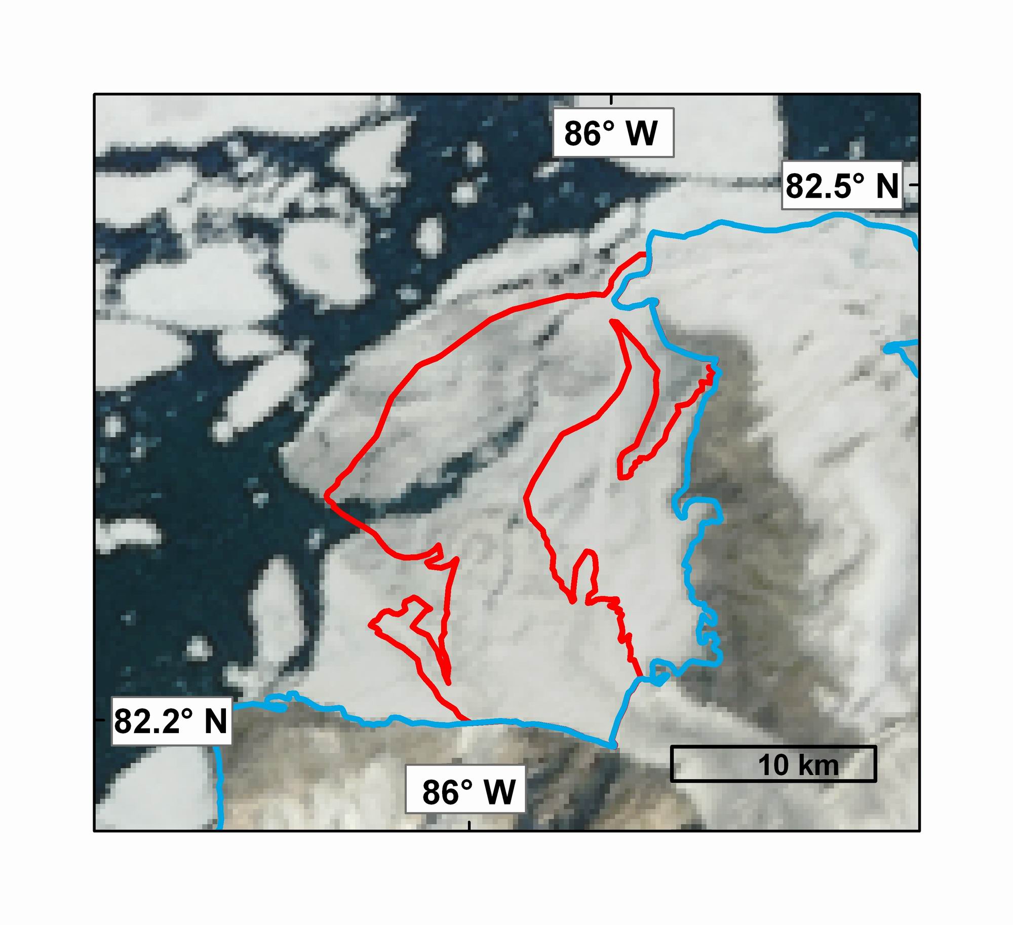
3) A MODIS image of the Serson Ice Shelf (2006 extent outlined in red) July 28, 2008 prior to its break-up in 2008. MODIS image from the Rapid Response Project at NASA/GSFC. Map courtesy Derek Mueller, Trent University
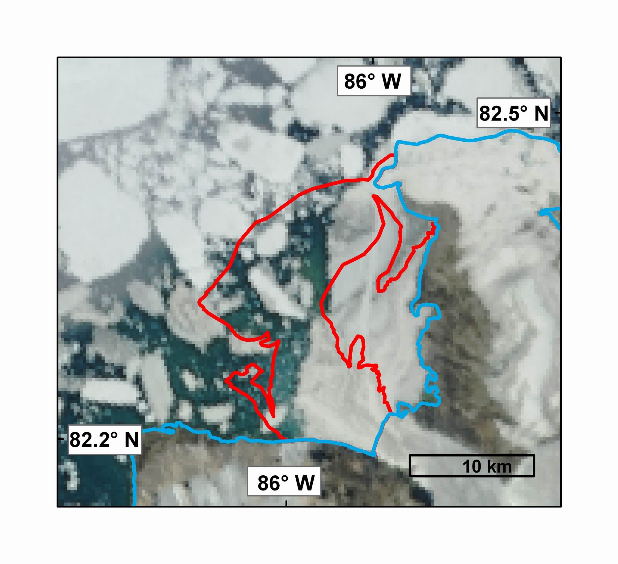
4) A MODIS image of the Serson Ice Shelf (2006 extent outlined in red) on July 30, 2008 after break-up has begun. MODIS image from the Rapid Response Project at NASA/GSFC. Map courtesy Derek Mueller, Trent University

5) A MODIS image of the Serson Ice Shelf (2006 extent outlined in red) on August 1, 2008, following additional break-up. MODIS image from the Rapid Response Project at NASA/GSFC. Map courtesy Derek Mueller, Trent University
6) A MODIS image of the Serson Ice Shelf (2006 extent outlined in red) on August 6, 2008. MODIS image from the Rapid Response Project at NASA/GSFC. Map courtesy Derek Mueller, Trent University.
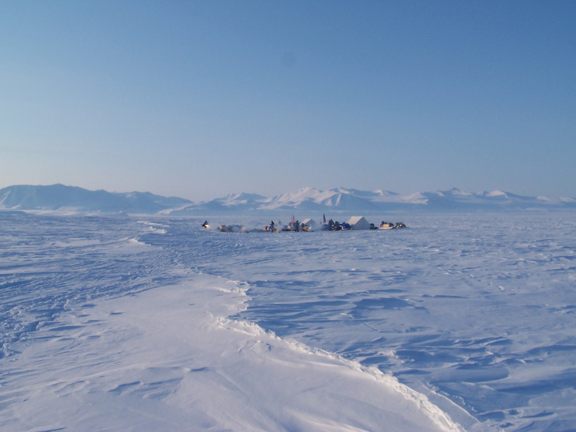
7) Camp on Cape Alfred Ernest next to the Serson Ice Shelf during a recent expedition to Northern Ellesmere Island. Photo courtesy Luke Copland, University of Ottawa.

8) A climate station installed near the Serson Ice Shelf. Data are available on the links page at the following site: www.madzu.com/ellesmere. Photo courtesy Luke Copland, University of Ottawa.

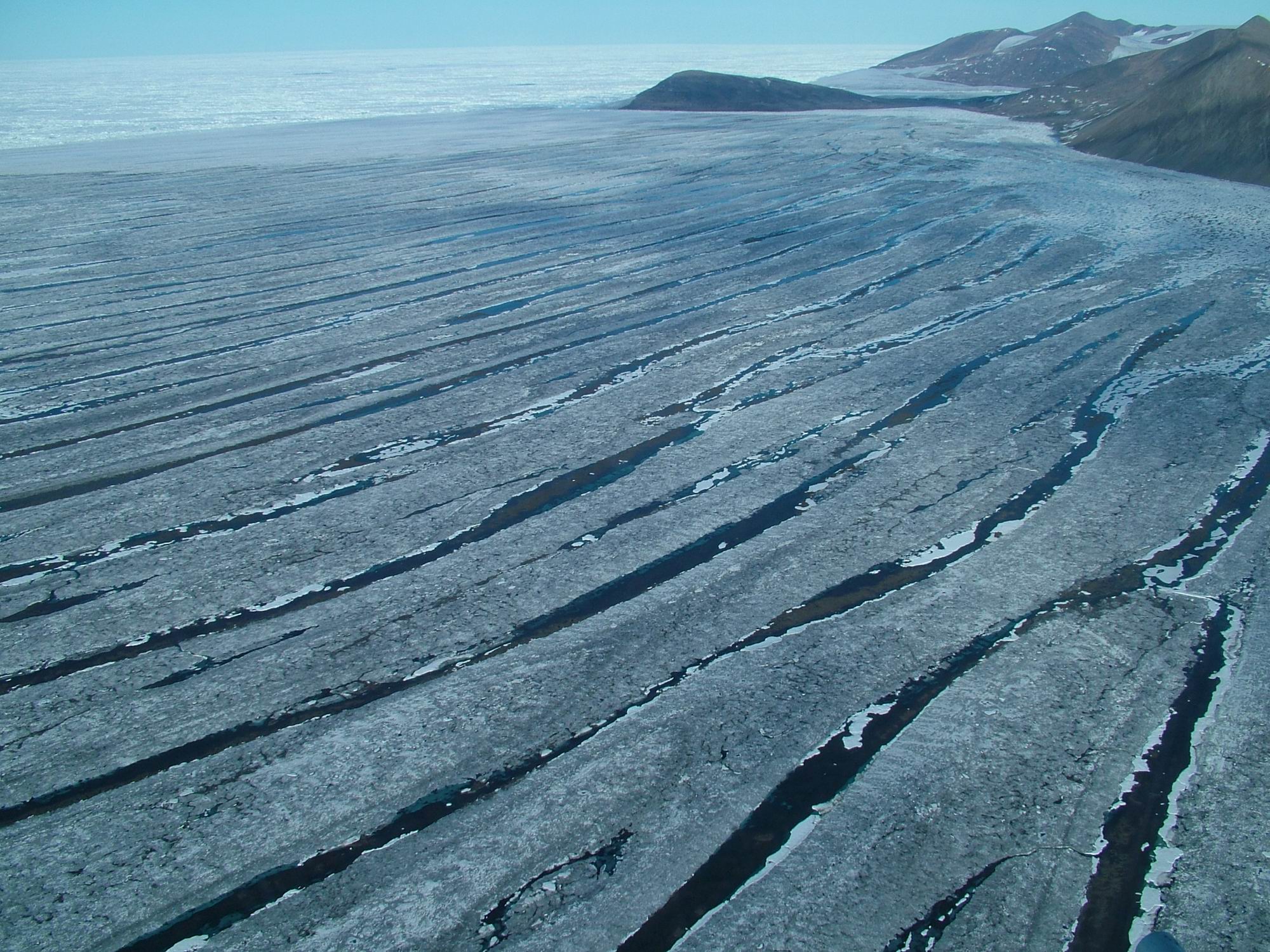
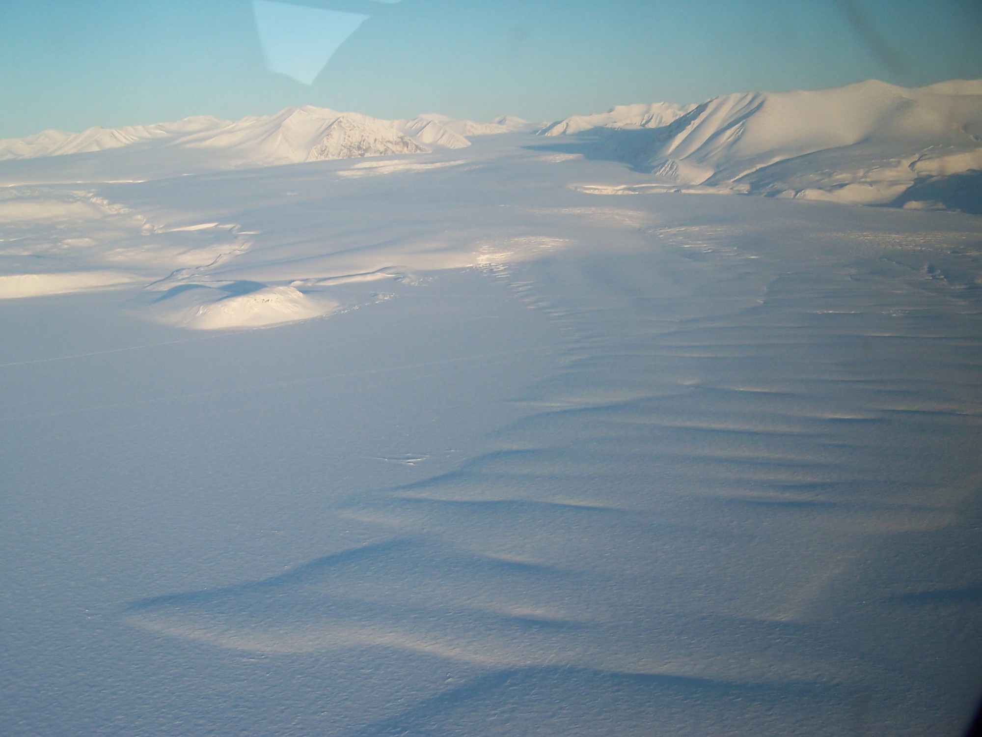
9) The gently rolling topography of the Serson Ice Shelf can be seen from the air. Photo courtesy Luke Copland, University of Ottawa.
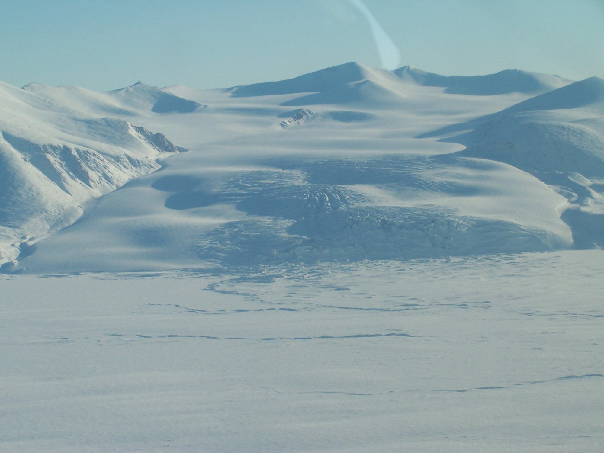
10) The Serson Ice Shelf is only partly composed of glacial ice with the other part made up of ancient sea ice and compacted snow. Here, the larger of two glaciers, whose floating tongues comprise the glacial portion of the shelf can be seen from an airplane. Photo courtesy Luke Copland, University of Ottawa.
11) The smaller of two glaciers, which feed the portion of the ice shelf composed of glacier ice descends a steep slope to the ocean. Photo courtesy Luke Copland, University of Ottawa.
Ward Hunt Ice Shelf
1) The Ward Hunt Ice Shelf break-up animated using cloud-free MODIS images. The animation shows an area that is approximately 75 km wide. NB: The events displayed here were already widely reported at the end of July. MODIS image from the Rapid Response Project at NASA/GSFC. Animation courtesy Derek Mueller, Trent University.
2) A FORMOSAT-2 image of the eastern Ward Hunt Ice Shelf (2006 extent outlined in red) on July 17, 2008. Note the piece of ice shelf and multiyear landfast ice detached off to the north of Ward Hunt Island. Image courtesy of Pax Arctica and the Planet Action Initiative, © NSPO 2008 – National Space Organization, Taiwan, Distribution Spot Image S.A., France, All rights reserved.
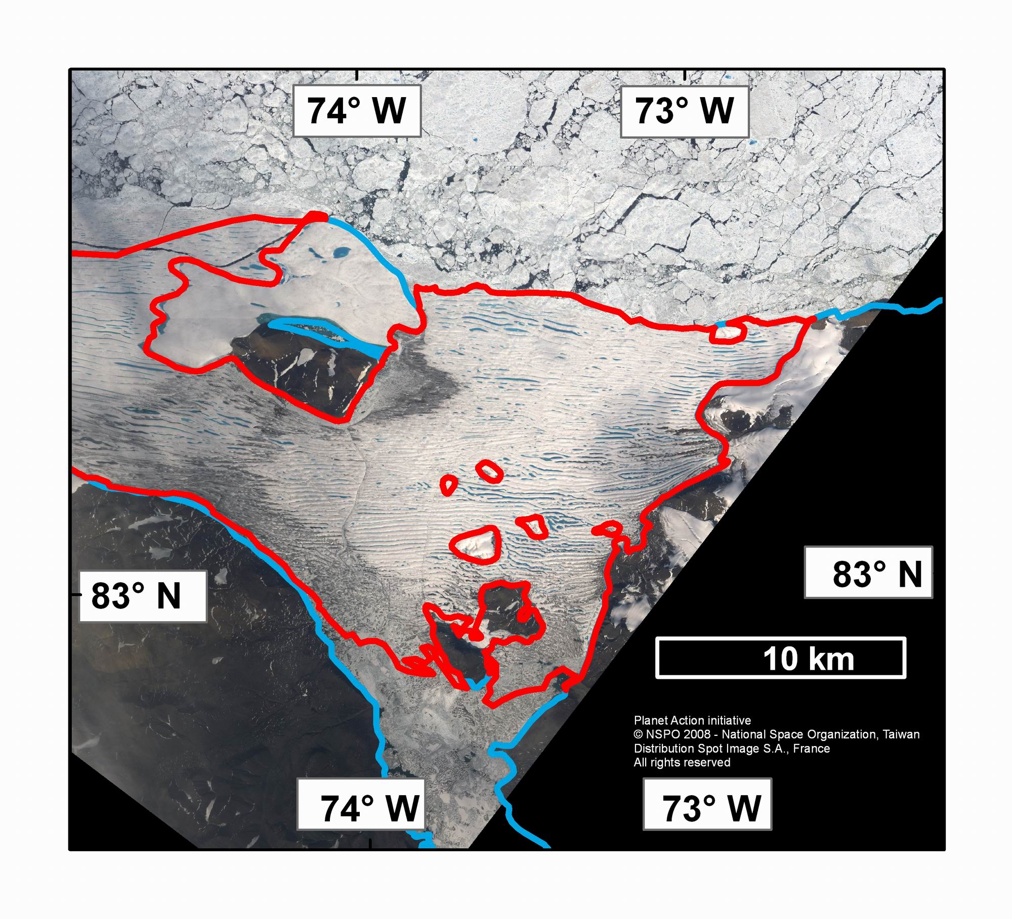
3) A FORMOSAT-2 image of the eastern Ward Hunt Ice Shelf (2006 extent outlined in red) on July 27, 2008. A 20 km2 area of the ice shelf has calved to the east of Ward Hunt Island. NB: These calving events were widely reported at the end of July. Image courtesy of Pax Arctica and the Planet Action Initiative, © NSPO 2008 – National Space Organization, Taiwan, Distribution Spot Image S.A., France, All rights reserved.

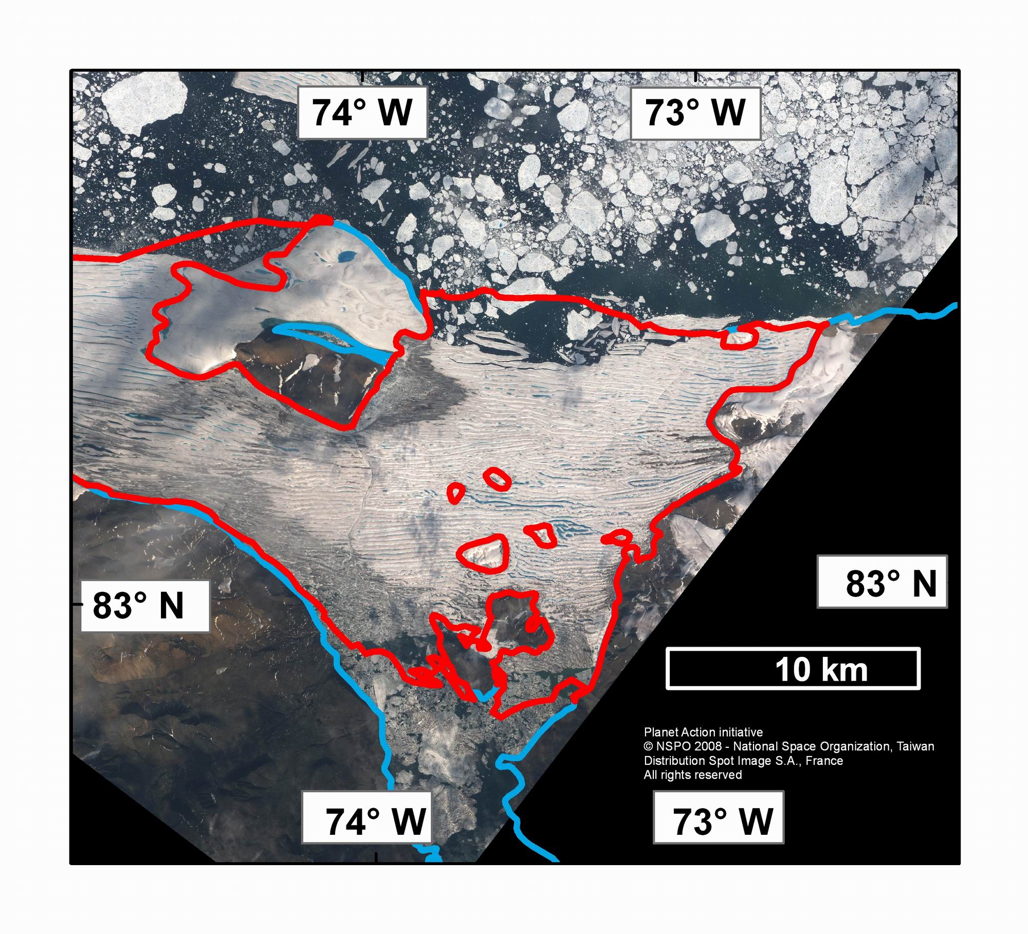
4) A FORMOSAT-2 image of the eastern Ward Hunt Ice Shelf (2006 extent outlined in red) on August 18, 2008. Note the new east-west cracks to the south of Ward Hunt Island and further loss at both the northern and southern calving fronts. New snow covers the ice shelf and some sea ice can be seen stuck to the northern edge of the ice shelf. Image courtesy of Pax Arctica and the Planet Action Initiative, © NSPO 2008 – National Space Organization, Taiwan, Distribution Spot Image S.A., France, All rights reserved.
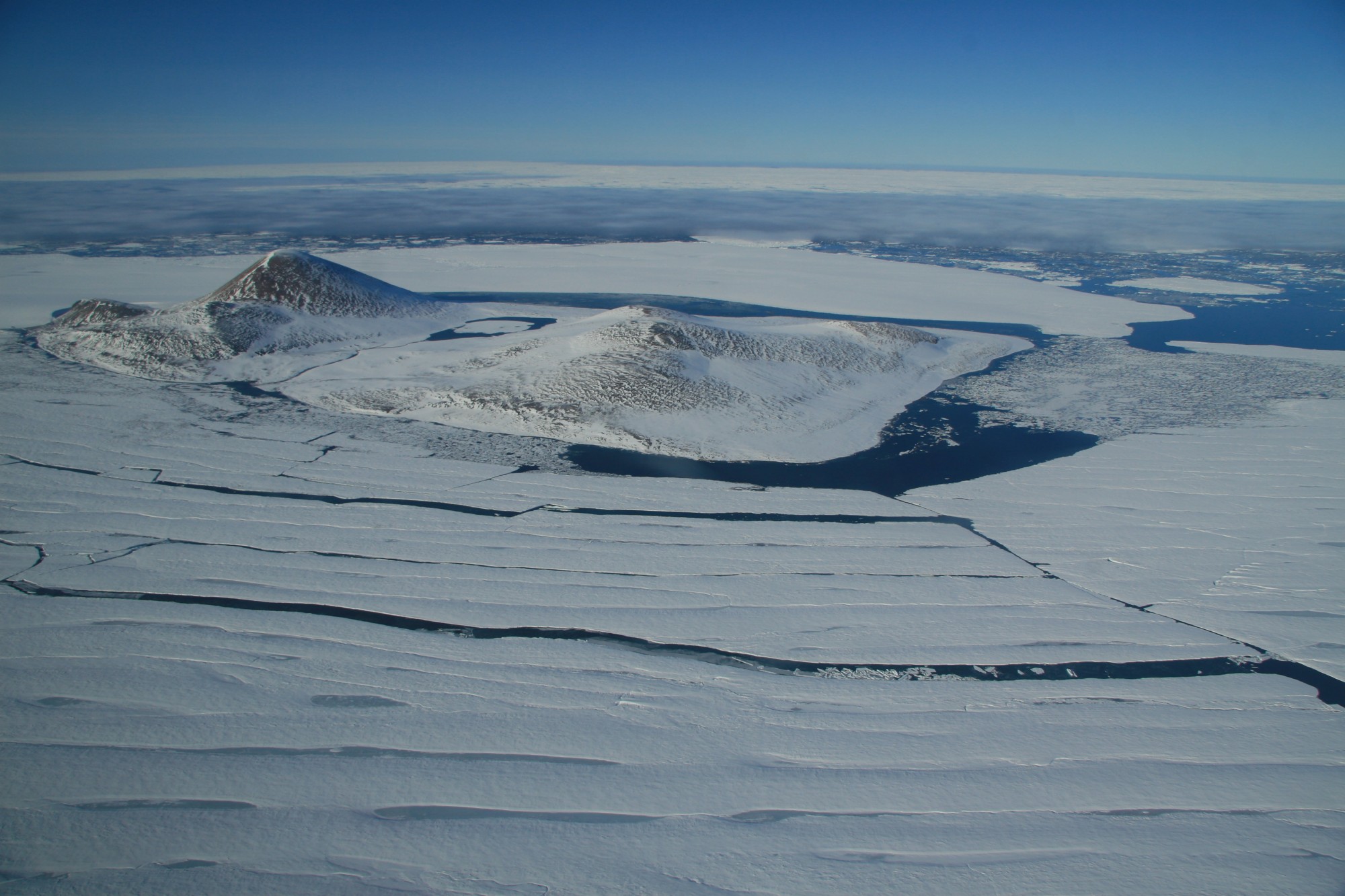
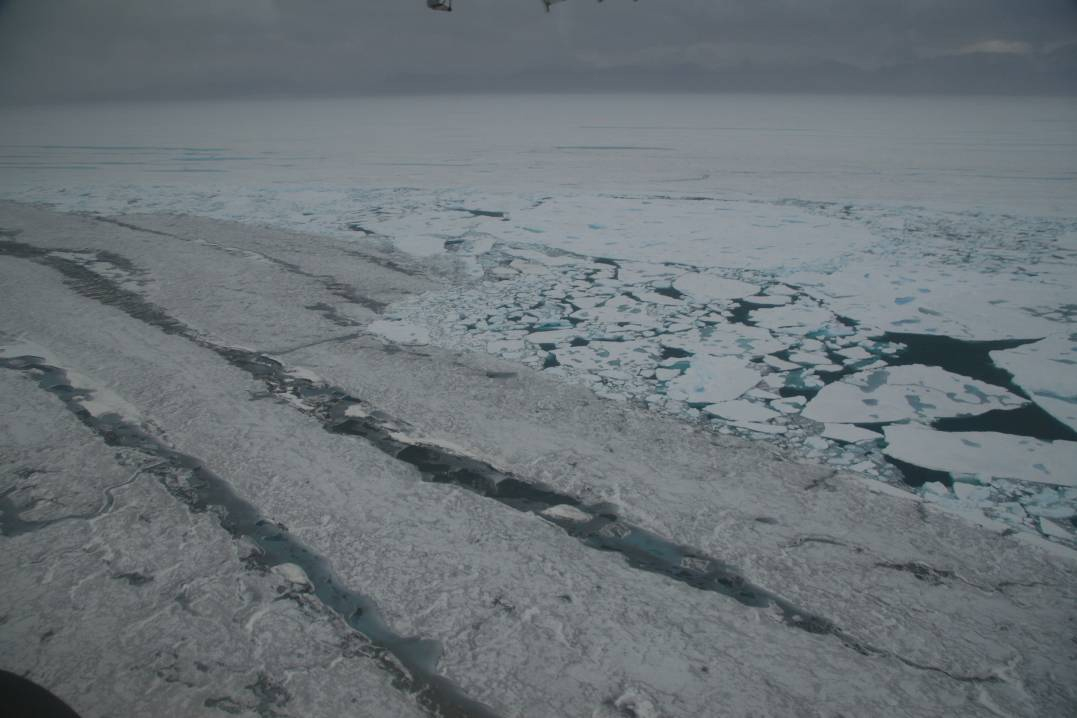
5) Ward Hunt Island and the crumbling Ward Hunt Ice Shelf to its south. Note the new cracks running to the west and calving to the north east of Ward Hunt Island. Photo courtesy of Denis Sarrazin, ArcticNet/Centre d’Etudes Nordiques.
6) The eastern portion of the Ward Hunt Ice Shelf with Cape Albert Edward in the background. Photo taken July 21, 2008 before widely reported calving of roughly 20 km2 of the ice shelf. © Luc Hardy/SAGAX, all rights reserved. Pax Arctica blog: www.sagaxexpeditions.com/blog/blog.html
7) The eastern portion of the Ward Hunt Ice Shelf with Cape Albert Edward in the background. Photo taken in mid-August, 2008. Compare with the photo above. Photo courtesy of Denis Sarrazin, ArcticNet/Centre d’Etudes Nordiques.
8) New cracks running into the western half of the Ward Hunt Ice Shelf. Photo courtesy of Denis Sarrazin, ArcticNet/Centre d’Etudes Nordiques.

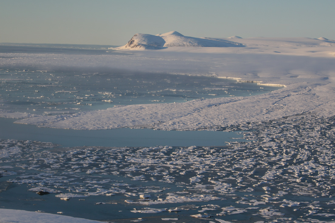
9) Calving of the Ward Hunt Ice Shelf into Disraeli Fiord during August 2008. Photo courtesy of Denis Sarrazin, ArcticNet/Centre d’Etudes Nordiques.
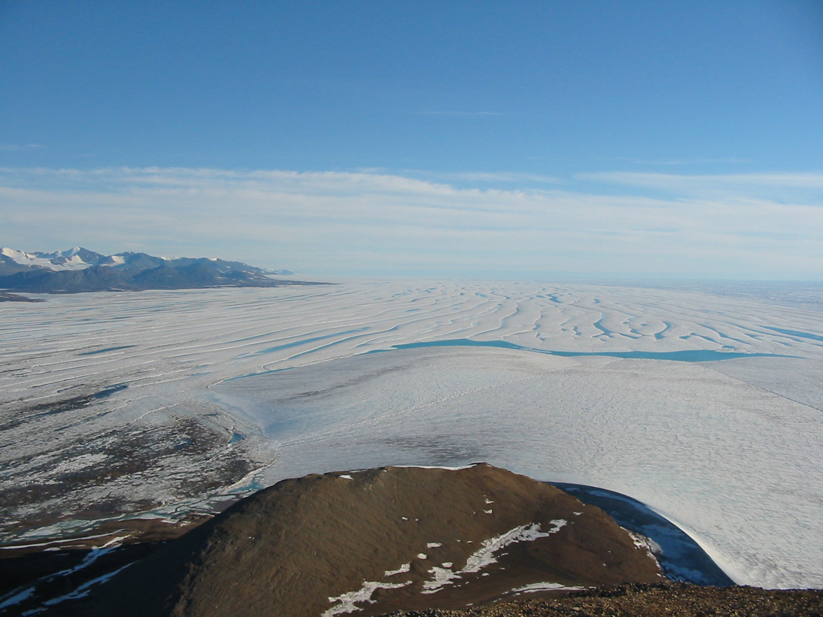
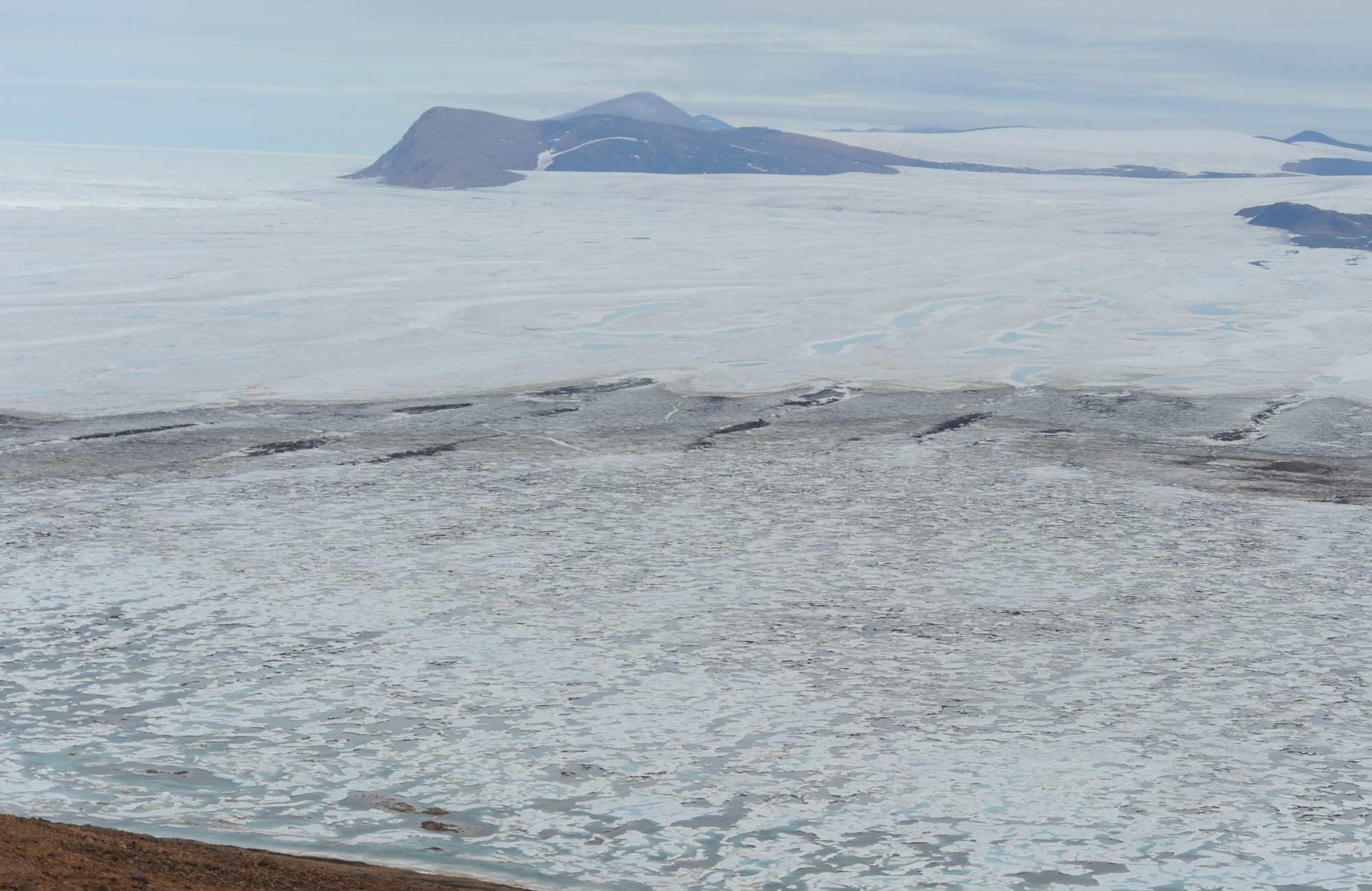
10) The western Ward Hunt Ice Shelf from the top of Walker Hill (430 m) on Ward Hunt Island during summer 2003. This portion of the ice shelf is still relatively intact. Photo courtesy of Derek Mueller, Trent University.

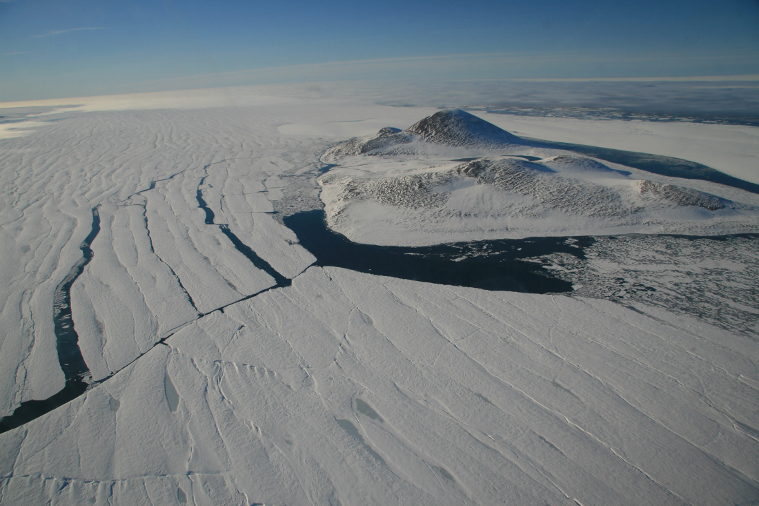
11) The eastern Ward Hunt Ice Shelf from the top of Walker Hill (430 m) on Ward Hunt Island during summer 2003. Much of the ice in this photo is broken up. The ice to the far left of the image has calved away. Photo courtesy of Derek Mueller, Trent University.
Links to related websites
Canadian Ice Service: www.ice-glaces.ec.gc.ca
ArcticNet: www.arcticnet.ulaval.ca/
International Polar Year MERGE Project: www.cen.ulaval.ca/merge/
Arctic ice shelves, their dependent ecosystems and the IPY Canadian Ranger Patrol 2008: www.madzu.com/ellesmere
Polar Continental Shelf Program: https://polar.nrcan.gc.ca/
Quttinirpaaq National Park: www.pc.gc.ca/eng/pn-np/nu/quttinirpaaq/index.aspx