Summer 2011 loss of Arctic ice shelves
Press Release September 27, 2011
Images related to specific ice shelves: Serson Ice Shelf Ward Hunt Ice Shelf Ellesmere Island Ice Shelves
Serson Ice Shelf 2011
The Serson Ice Shelf was reduced from 205 km2 to two separate remnant sections in 2008: Serson A, a 42 km2 floating glacier tongue and Serson B (35 km2) just to the north. This past summer, the Serson A was reduced to a 25 km2 and the Serson B was reduced to 7 km2.
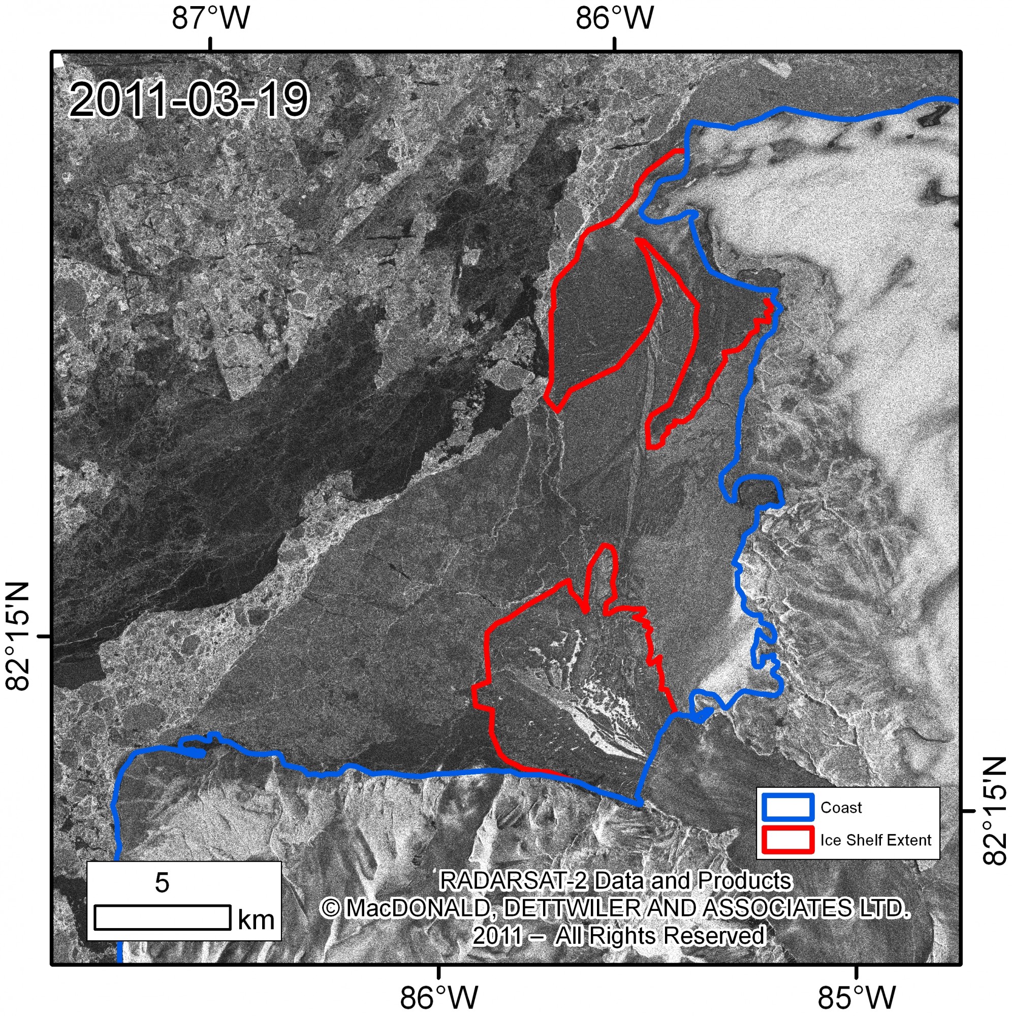
The extent of the remnants of Serson Ice Shelf on March 19, 2011 (red) before summer 2011 break-up. Serson A is a floating glacier tongue (south) and Serson B is composed of thick, ancient sea ice (north). Blue denotes the coast of Ellesmere Island. Radarsat-2 fine beam imagery © MDA 2011, Distribution licensed by MDA-GSI for the SOAR program. RADARSAT is an official mark of the Canadian Space Agency. Map courtesy of Derek Mueller, Carleton University.
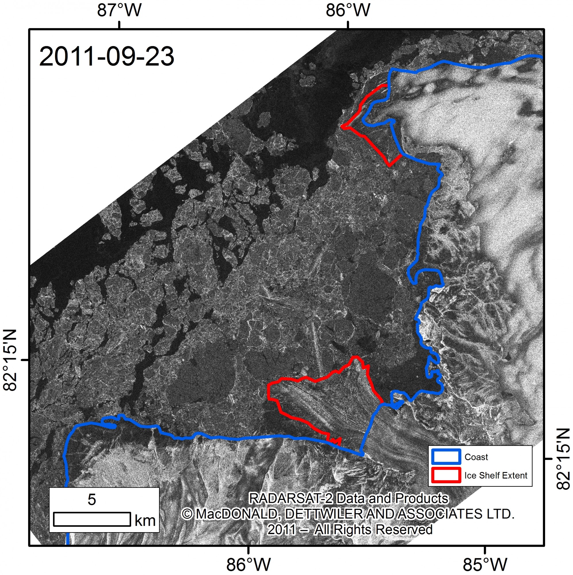
The extent of the remnants of the Serson Ice Shelf on September 23, 2011 (red) following summer 2011 break-up. Serson A is a floating glacier tongue (south) and Serson B is composed of thick, ancient sea ice (north). Blue denotes the coast of Ellesmere Island. Radarsat-2 fine beam imagery © MDA 2011, RADARSAT is an official mark of the Canadian Space Agency. Map courtesy of Derek Mueller, Carleton University.
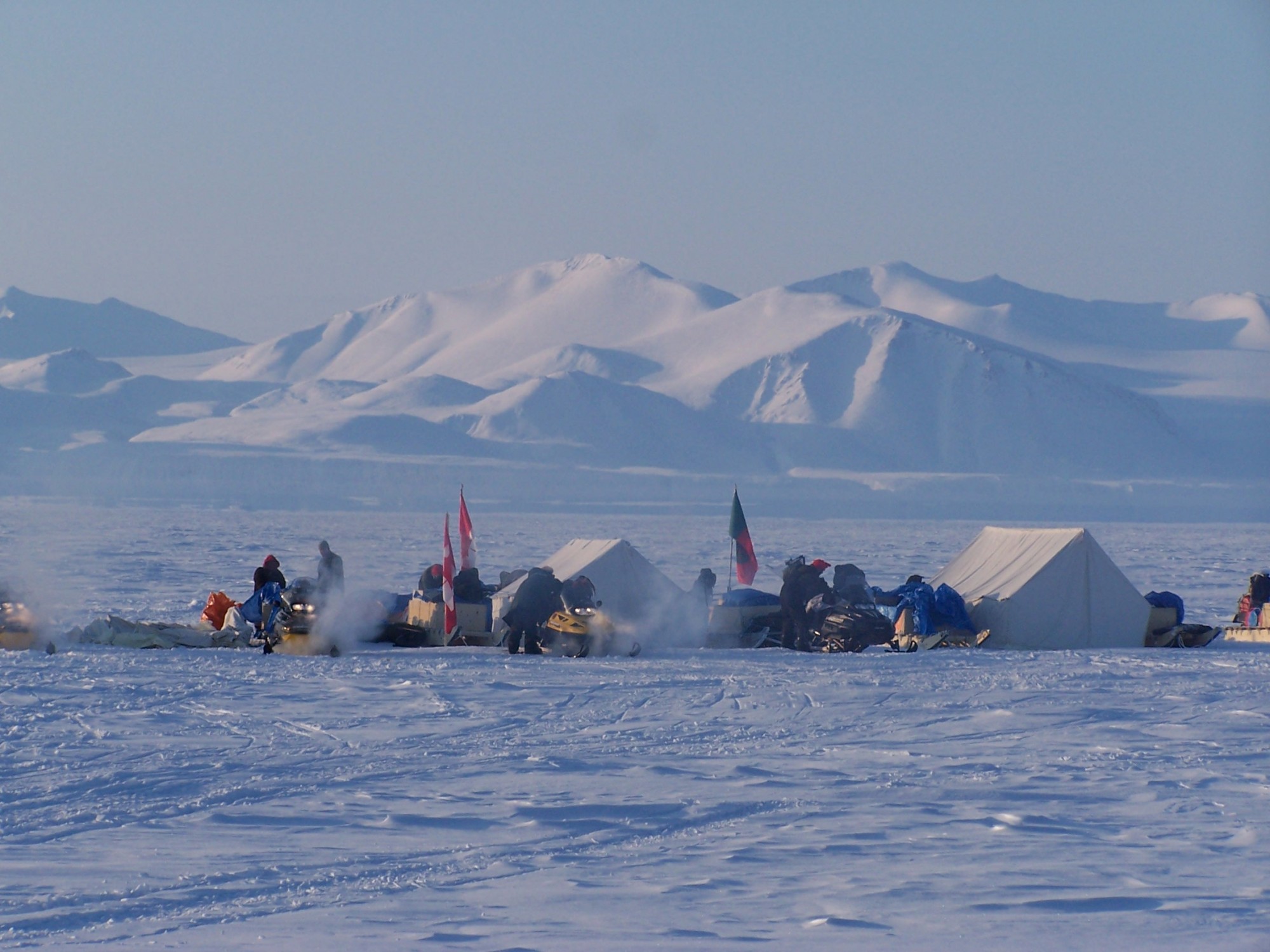
Scientists and Canadian Rangers involved in ice shelf research camp overlooking the Serson Ice Shelf April 2008. Photo courtesy of Luke Copland, University of Ottawa.
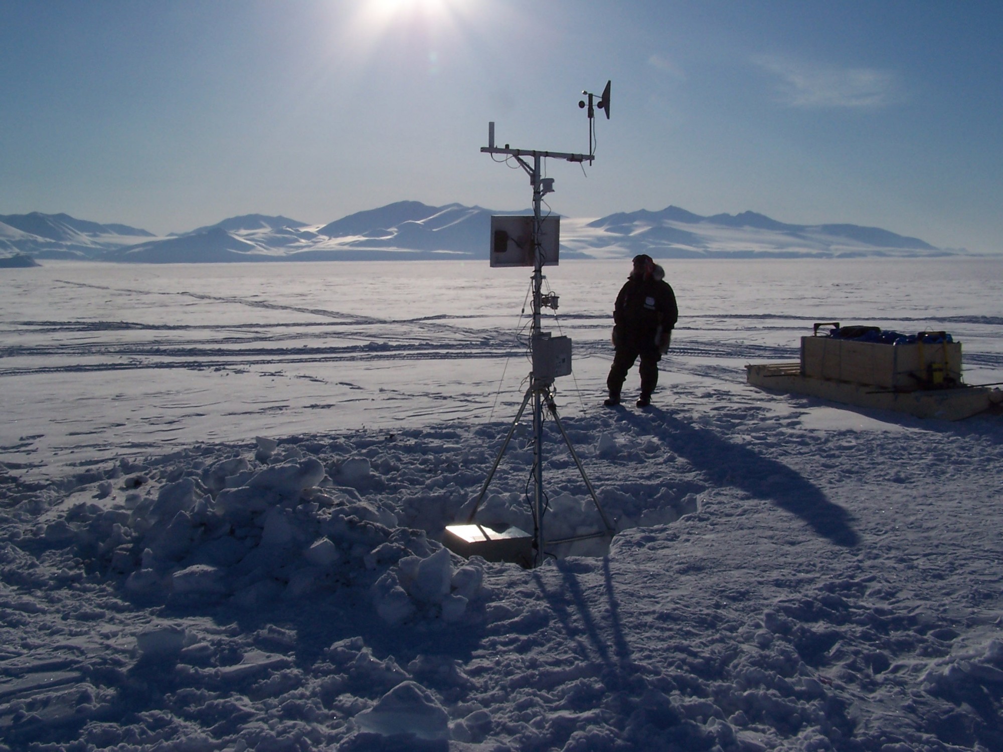
A climate station adjacent to the Serson IceShelf. Photo courtesy of Luke Copland, University of Ottawa.

Harold Serson (1926-1992) at home in the Arctic. Serson was an Arctic scientist who worked on ice shelves and related phenomena in northern Ellesmere Island. The Serson Ice Shelf was officially named after him in 2006. Photo courtesy of Martin Jeffries, University of Alaska Fairbanks.
Ward Hunt Ice Shelf 2011
Last year, the Ward Hunt Ice Shelf was 340 km2 with its central area broken into pieces. This past summer, the central area disintegrated into drifting ice masses, leaving two separate ice shelves: a western (227 km2) and an eastern (74 km2) Ward Hunt Ice Shelf.
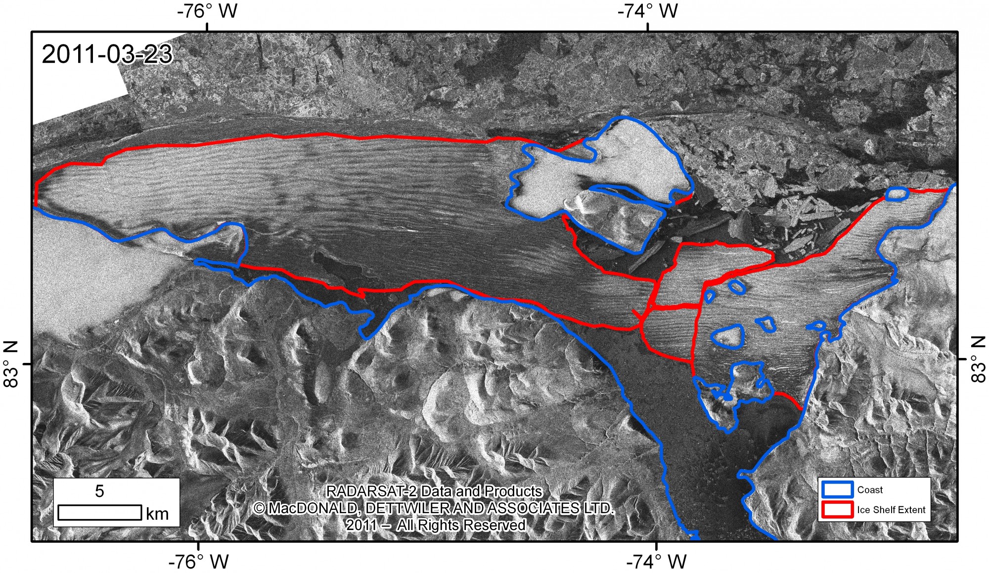
The extent of the Ward Hunt Ice Shelf on March 23, 2011 (red) before summer 2011 break-up. Blue denotes the coast. Radarsat-2 fine beam imagery © MDA 2011, Distribution licensed by MDA-GSI for the SOAR program. RADARSAT is an official mark of the Canadian Space Agency. Map courtesy of Derek Mueller, Carleton University.
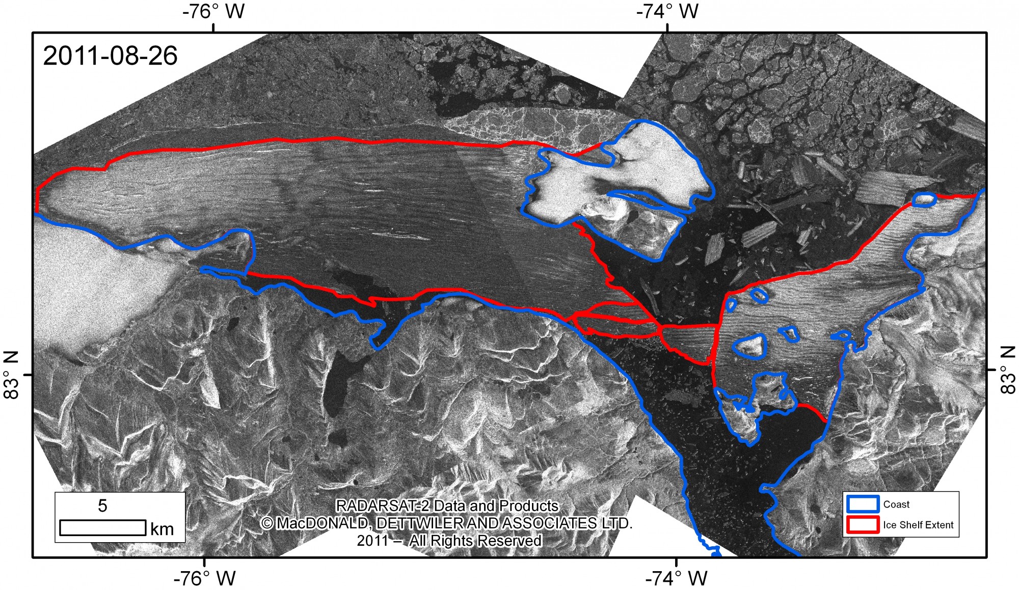
The extent of the Ward Hunt Ice Shelf on August 26, 2011 (red) during summer 2011 break-up. Blue denotes the coast. Radarsat-2 fine beam imagery © MDA 2011. RADARSAT is an official mark of the Canadian Space Agency. Map courtesy of Derek Mueller, Carleton University.
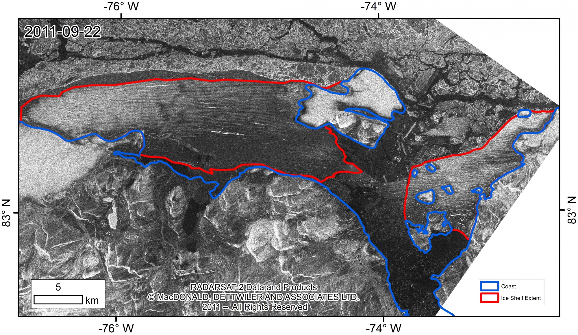
The extent of the Ward Hunt Ice Shelf on September 22, 2011 (red) following summer 2011 break-up. Blue denotes the coast. Radarsat-2 fine beam imagery © MDA 2011. RADARSAT is an official mark of the Canadian Space Agency. Map courtesy of Derek Mueller, Carleton University.

Calving of the Ward Hunt Ice Shelf into Disraeli Fiord during August 2008. Photo courtesy of Denis Sarrazin, ArcticNet/Centre d’Etudes Nordiques.
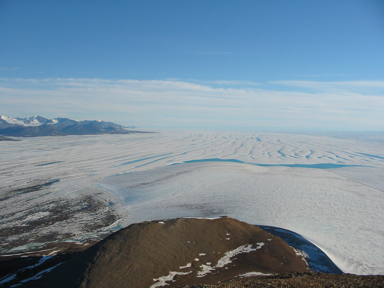
The western Ward Hunt Ice Shelf from the top of Ward Hunt Island during summer 2003. The area to the left of the picture has now broken away. Photo courtesy of Derek Mueller, Carleton University.

The eastern Ward Hunt Ice Shelf from the top of Ward Hunt Island during summer 2003. Much of the ice in this photo is now broken up. Photo courtesy of Derek Mueller, Carleton University.
Ellesmere Island Ice Shelves 2011
In 1906, the Ellesmere Island ice shelves were an estimated 8900 km2 and were reduced to 1043 km2 over the last century. The total extent of Ellesmere ice shelves is now 563 km2 or 54 per cent of what it was prior to the loss of the Ayles Ice Shelf in August 2005.
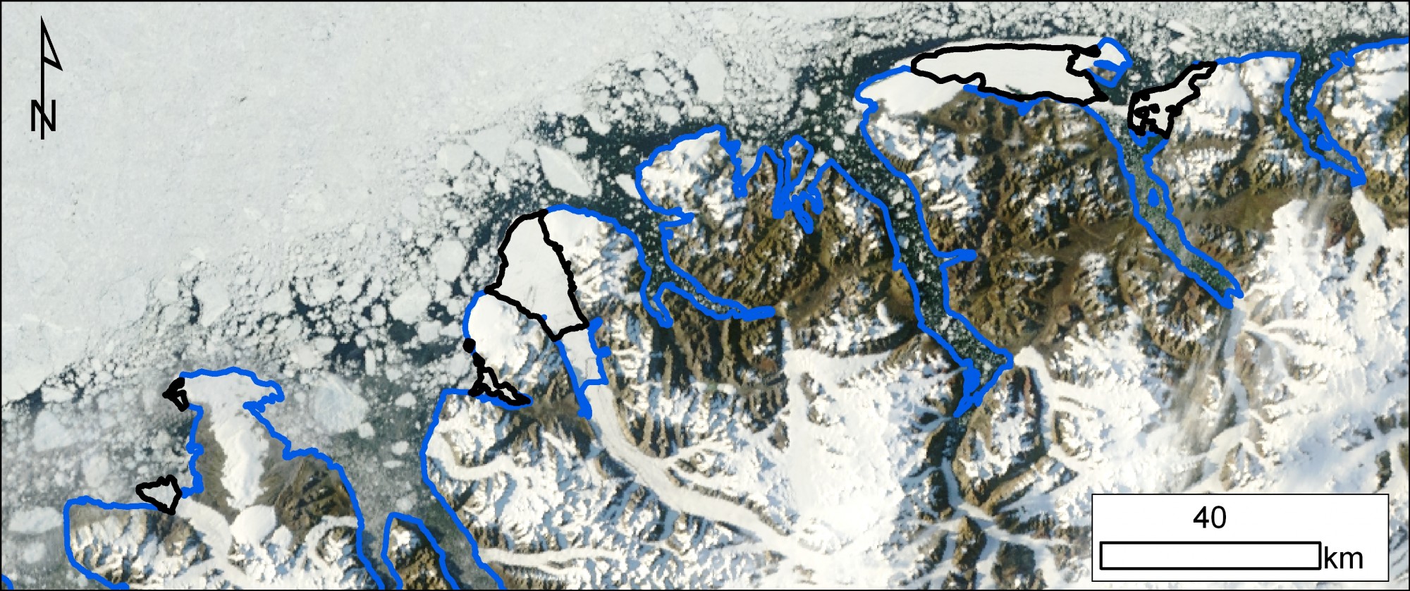
Map of Ellesmere Island ice shelves at the end of August 2011. Ice shelves are outlined in black and land is outlined in blue. Left to Right: Serson (A and B), Petersen, Milne and Ward Hunt (West and East). August 26, 2011 MODIS image from the Rapid Response Project at NASA/GSFC. Map courtesy of Derek Mueller, Carleton University.
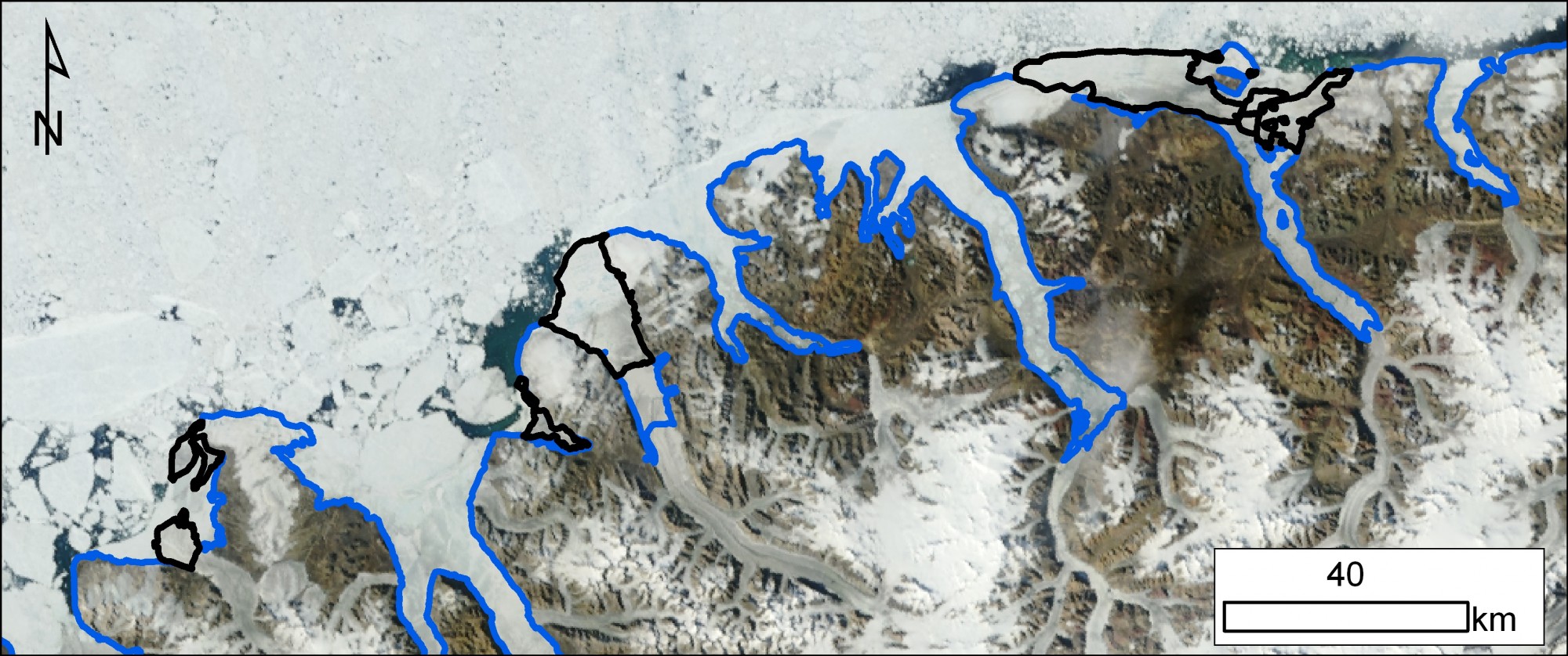
Map of Ellesmere Island ice shelves prior to break-up during summer 2011. Ice shelves are outlined in black and land is outlined in blue. Left to Right: Serson (A and B), Petersen, Milne and Ward Hunt. July 21, 2011 MODIS image from the Rapid Response Project at NASA/GSFC. Map courtesy of Derek Mueller, Carleton University.

Map of Ellesmere Island ice shelves prior to major changes over the last six years. Ice shelves are outlined in black and land is outlined in blue. Left to Right: Serson, Petersen, Milne, Ayles, Ward Hunt and Markham August 8, 2005 MODIS image from the Rapid Response Project at NASA/GSFC. Map courtesy of Derek Mueller, Carleton University.
Links to related websites
Canadian Ice Service: www.ice-glaces.ec.gc.ca
ArcticNet: www.arcticnet.ulaval.ca/
International Polar Year MERGE Project: www.cen.ulaval.ca/merge/
Arctic ice shelves, their dependent ecosystems and the IPY Canadian Ranger Patrol 2008: www.madzu.com/ellesmere
Polar Continental Shelf Program: https://polar.nrcan.gc.ca/
Quttinirpaaq National Park: www.pc.gc.ca/eng/pn-np/nu/quttinirpaaq/index.aspx