Skip to content
Search for:
Home
News
Our Team
Water
Ice
Research
Water
Hydrology
Snare River Basin
Apex River Watershed
Metals
Arsenic in Yellowknife Lakes
Mercury in Arctic Snow
Metals in Arctic lakes
Methylmercury Bioaccumulation
Wetlands
Gatineau Park Wetlands
Alfred Bog
Wetland Remote Sensing
Ice
Ice shelves
Milne Ice Shelf
Nansen Ice Shelf
Ice Shelf Extents
2020 Calving Event
2011 Calving Event
2008 Calving Event
Ice Islands
Iceberg Beacon Track Database
CI2D3
Iceberg Mapping
Ice Island Deterioration Model
Ice Penetrating Radar
Resolute Iceberg Study
Project ICEBERGS
Drift Modelling
Tracking
Sea Ice
Landfast Ice Breakup
Ice Topography
Epishelf Lakes
Milne Epishelf Lake
Disraeli Epishelf Lake Drainage
Cryologger
Gallery
Publications
Water
Ice
Contact
Home
Research
Research – Ice
Ice Islands
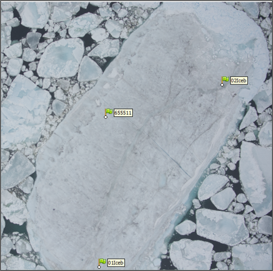
Iceberg Mapping
IceIslandPhotogrammetryPhoto
IceIslandPhotogrammetryPhoto
Derek Mueller
2017-07-19T21:38:26-04:00
Page load link
Go to Top