Ice Islands: Ice penetrating radar (IPR)
 Ice islands are large, tabular icebergs which pose a hazard to shipping and offshore hydrocarbon industry activities. Marine traffic is increasing in the Canadian Arctic, as is the prevalence of ice islands. It is therefore imperative that the process of ice island deterioration be understood to adapt best practices to properly mitigate risk in the future. In-situ data, specifically regarding thickness and deterioration rates, is necessary for these analyses and operational model development. However, this information is exceedingly difficult to obtain due to logistical constraints.
An ice island’s drift trajectory is affected by its freeboard (above-water height) and keel (below-water depth), as these dimensions will determine the wind and ocean current forces to which the ice island is subject. Sampling operations in 2015 collected valuable in-situ data on the change of these dimensions over time.
 Anna Crawford and a technician (Graham Clark) accessed Petermann Ice Island (PII)-A-1-f, a 14 km2 ice island fragment from the 2012 Petermann Glacier calving, from the CCGS Amundsen during the annual ArcticNet research cruise on 20 October 2015. PII-A-1-f is a fragment of the 130 km2 PII which originally calved from the Petermann Glacier of northwest Greenland in 2012. PII-A-1-f was grounded in Baffin Bay at 67°23’N, 63°18’W, 35 km southeast of Qikiqtarjuaq, NU.
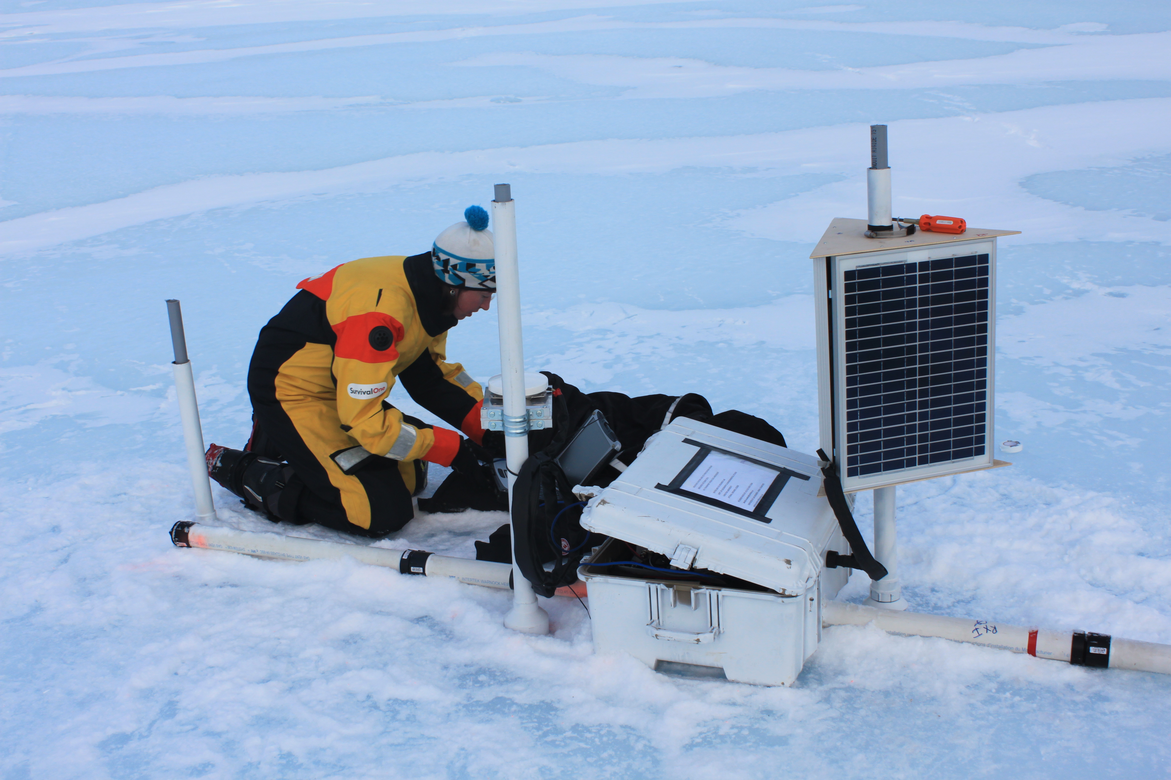
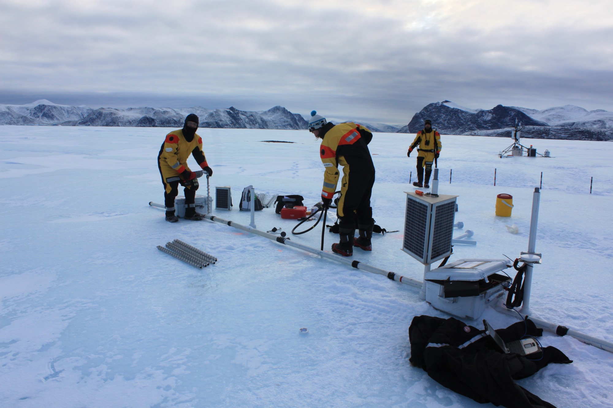
The priority field work consisted of deploying two systems: an ice penetrating radar (IPR) and a meteorological station. The former collects daily thickness measurements, while the latter records hourly air and ice temperature, surface melt (with a sonic ranger) and location. A camera is also installed and programmed to capture a weekly image of the IPR for remote monitoring of its physical set-up. The concurrent data-sets of thickness change and surface melt will result in first continuous, in-situ monitoring of an ice island’s mass balance within the Canadian Arctic.
Both systems are transferring their respective data-sets daily via satellite. This allows for monitoring of the ice island’s thinning and surface melt in near real-time. Two GPS beacons were deployed on the ice island as additional monitors of future movement.
Support
This project was undertaken with the financial support of:
![]()
![]()
![]()